


DELMARVA - Mild, summerlike weather will hold over Sussex County Tuesday before an approaching cold front brings unsettled conditions overnight into early Wednesday.
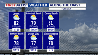
A warm front will lift through the region Tuesday morning, ushering in warmer air and clearing skies. High temperatures will climb into the low to mid-80s inland, with 70s along the coast. Light southerly winds will draw moisture into the area, keeping conditions humid throughout the day.
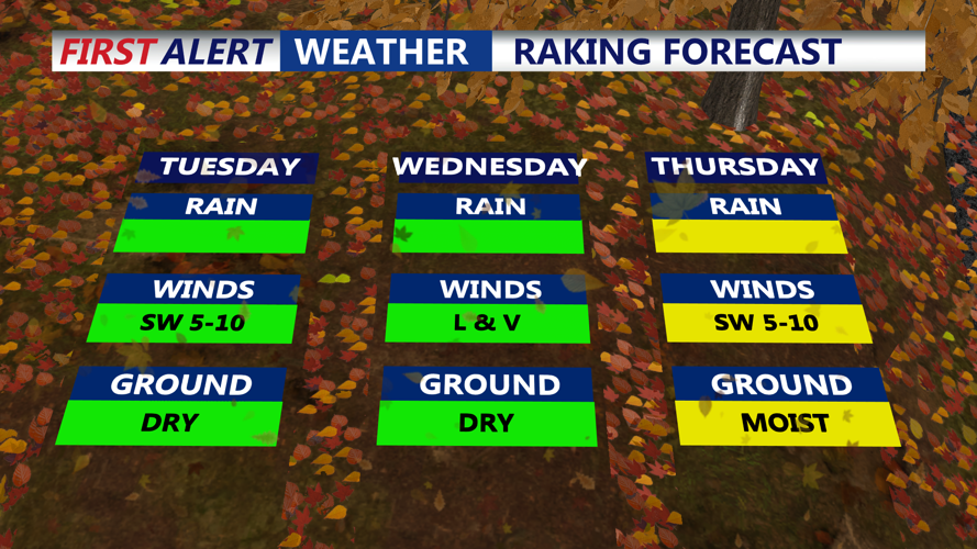
By late Tuesday afternoon and evening, an approaching cold front and upper-level disturbance will spark showers and isolated thunderstorms across the region. The greatest chance of storms will be northwest of the I-95 corridor, but Sussex County may also experience periods of rain and a few rumbles of thunder overnight.
While a few storms could briefly become strong, the severe threat is limited due to marginal instability and the loss of daytime heating after sunset. Expect the rain to taper off after midnight, with low temperatures holding in the mid-60s.
Wednesday will begin mostly cloudy and mild as the front lingers nearby. Highs will again reach the upper 70s to low 80s during the day, with another chance for scattered showers or isolated thunderstorms as the system slowly moves southward.