



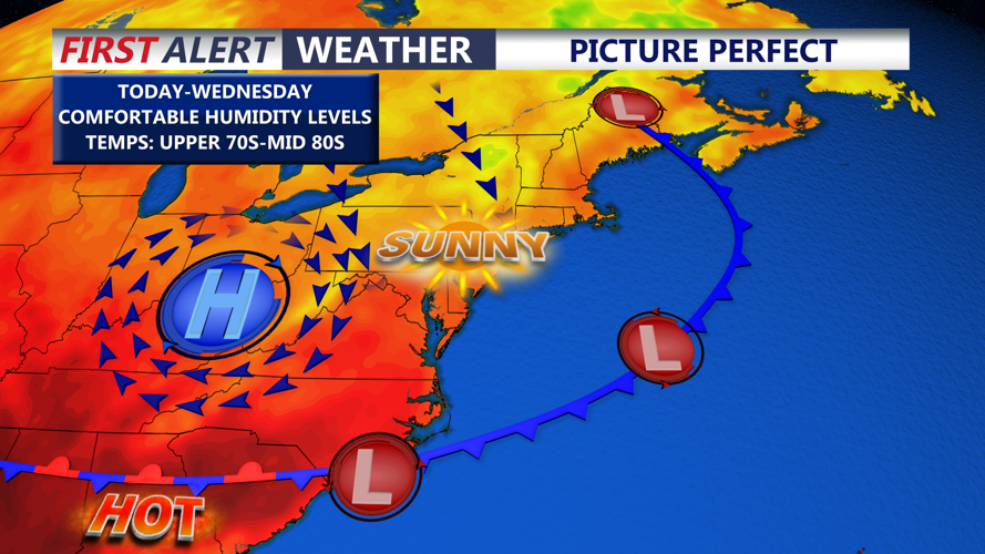

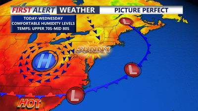
DELMARVA -- A beautiful late-August day is ahead across the peninsula today as high pressure continues to build toward the region.
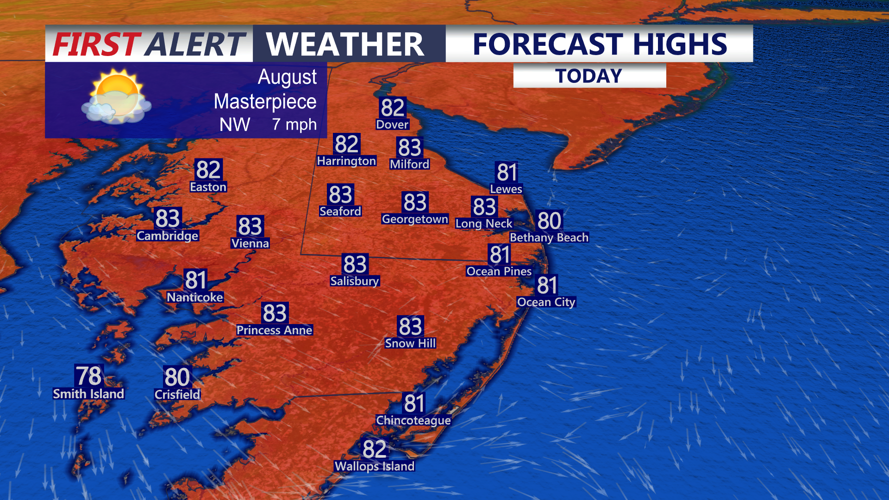
Mostly sunny skies are expected with afternoon temperatures reaching the upper 70s to low 80s. Northwest winds will remain light at 5 to 10 mph, keeping humidity levels comfortable through the day.

Mostly sunny skies and highs in the upper 70s to low 80s, northwest winds 5 to 15 mph.
A weak disturbance passing nearby could produce a few additional clouds during the afternoon, but the atmosphere is expected to remain stable enough to keep most of Delmarva dry.

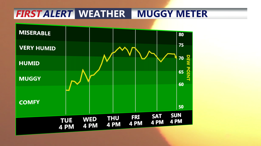
Humidity levels will be on the rise Wednesday into Thursday as tropical air returns by late week.
Tonight will be mostly clear and pleasantly cool. Temperatures will fall into the upper 50s across some inland communities, while most locations settle into the low to mid 60s.
High pressure remains in control Wednesday, providing another generally dry and comfortable day before the weather pattern begins changing. Highs Wednesday will be in the mid to upper 80s.

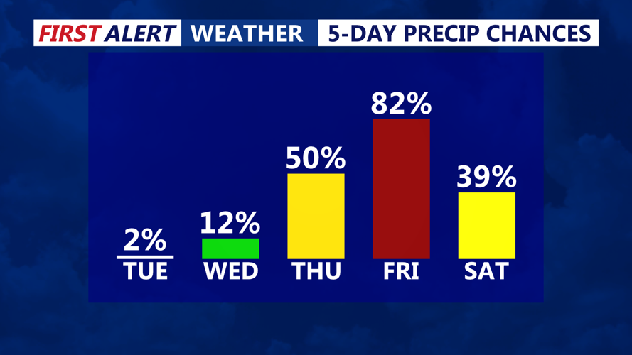
Warm front will bring a chance of storms late Thursday, better chance for scattered storms with a cold front Friday.
A warm front will approach Delmarva late Wednesday night into Thursday morning. Southerly winds behind the front will bring noticeably higher humidity, with dew points climbing back into the lower 70s.
Thursday looks like a partly sunny day, right now it appears the greatest chance for thunderstorms and severe storms would be northern portions of the peninsula and right along the I-95 Corridor, highs in the mid to upper 80s. I think most of the coast stays dry at this point with an isolated t-storm late.
Atmospheric moisture will increase enough late week to create a marginal threat for locally heavy rainfall and isolated flash flooding. Moisture levels will be elevated for late August, although current projections remain below those associated with some of the more significant heavy rain events Delmarva has experienced recently.
The threat for severe thunderstorms Thursday currently appears limited because both atmospheric instability and wind shear are expected to remain modest. Still, a few stronger storms cannot be ruled out and the situation will continue to bear watching.
A cold front is expected to follow quickly on Friday, bringing another opportunity for showers and thunderstorms. The timing of that front will play an important role in determining how widespread or strong Friday's storms could become.
Forecast guidance is increasingly pointing toward improving and drier conditions Saturday as cooler and less humid air begins moving back onto Delmarva.
