


A much warmer pattern is taking over across Delmarva this weekend and will continue into the middle of next week.
From
To

Sussex County is expected to stay warm and mainly dry from early Tuesday into early Wednesday, with only a limited chance of a passing late-day shower or storm Tuesday.

A passing front brings a few brief showers and gusty winds late Sunday afternoon before clearing and a mainly sunny, seasonable Monday in Sussex County.

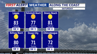
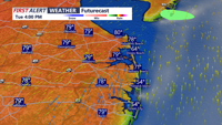
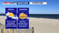
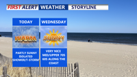
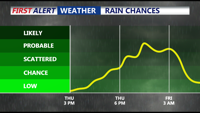
Mix of sun and clouds Friday with an isolated shower, highs in the mid 80s. Delmarva will enjoy a warm and mostly pleasant weekend with highs in the 80s, light onshore winds, and only isolated shower chances. A stronger cold front Sunday night into Monday will bring cooler, drier air to start next week. Keeping our eyes on Erin churning in the southern Atlantic.

A stalled cold front over the Mid-Atlantic will keep Delmarva in a pattern of warm, humid, and occasionally unsettled weather through the weekend, with isolated showers possible and temperatures in the 80s. A stronger cold front will bring cooler, drier air early next week. Keeping an eye on Erin as the storm will become a hurricane by Friday.

Delmarva enters a stretch of mild, mostly dry weather beginning Wednesday night, thanks to high pressure settling to the north and northeast. Although a weak coastal low may trigger a few isolated showers later this week, most areas will remain dry with gradually warming temperatures. Humidity will increase early next week, bringing hot conditions and a slight chance of showers and storms.

From early Tuesday through early Thursday, Sussex County will experience mild nights, cooler daytime highs, and mainly dry weather, with only a minimal risk of isolated showers inland.

Rain will increase in intensity overnight into Thursday morning in Sussex County, with the possibility of thunderstorms and minor flooding before showers gradually taper off late Thursday.

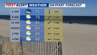
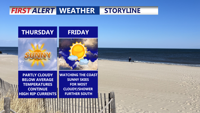
Patchy fog gives way to partly sunny skies and warm temperatures. A mix of isolated showers and storms will punctuate the rest of the week as multiple upper-level systems move through the region, bringing cooler temperatures and increased rain chances into the weekend.

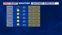
High pressure dominates Delmarva tonight, bringing calm winds, clear skies, and sub-freezing overnight temperatures inland. Rain chances increase late Thursday into Friday as a low-pressure system develops nearby, but precipitation amounts are expected to be light. The weekend promises drier and milder conditions as Canadian high pressure builds into the region, with temperatures climbing into the 60s by Saturday. A weak frontal system may bring isolated showers late Sunday into early Monday, but dry weather returns midweek with above-normal temperatures.