


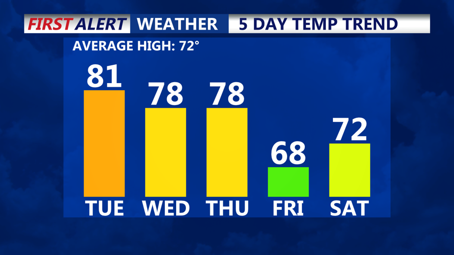

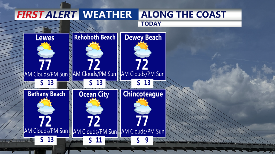

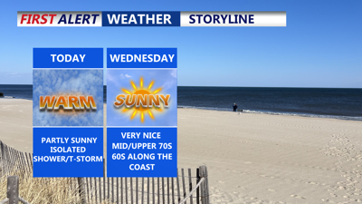
DELMARVA -- Patchy fog and low clouds greeted Delmarva residents Tuesday morning, but skies are expected to become partly sunny as the day progresses. Highs will range from 75 to 81 degrees inland, with cooler temperatures along the coast in the low to mid-70s.

Remaining above average at least through Friday.
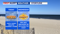
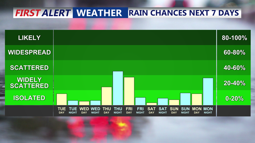
An isolated shower or thunderstorm can’t be ruled out through Tuesday evening, as southeast winds shift southwest and eventually west at 10 to 15 mph.

Highs along the coast will be in the 70s, with an isolated shower or storm.
By Tuesday night, a stubborn upper-level low will drift from northern Pennsylvania into New York State, bringing a renewed chance for showers and a few thunderstorms. Although coverage will be limited, there is a slight 20 percent chance of rain across the Delmarva Peninsula. Overnight lows will dip into the 50s.

Isolated shower or storm chances, better chance of rain Friday.
On Wednesday, the same upper low is expected to lift northeast, merging with the polar jet. A few lingering showers may persist into the afternoon before drier air arrives. Highs will again top out in the mid to upper-70s, with nighttime lows in the 50s.
By Thursday, another upper-level trough will quickly follow, bringing increasing chances of showers and possibly a few thunderstorms through the afternoon and evening. While forecast confidence is lower regarding rainfall intensity, high temperatures are expected to remain in the mid to upper 70s, cooler near the coast. Lows will fall into the mid to upper 50s.
Friday may be the soggiest day of the week as the new closed low settles over the Mid-Atlantic and supports low pressure near the New Jersey coast. Showers and embedded thunderstorms are likely throughout the day. Abundant clouds and rain-cooled air will suppress temperatures, with highs only reaching the 60s. Rain will taper off Friday night as the low exits, with lows falling into the 40s.
The departing low will weaken on Saturday, allowing some sunshine to return, though lingering troughing aloft may keep clouds around. Highs will begin to moderate. Another cold front arrives Mother's Day with limited moisture, so going with mainly dry conditions as of now with highs in the upper 70s.
By Monday, high pressure is forecast to build in from the west, delivering drier and warmer weather. Temperatures will rise, though light winds could allow for a sea breeze during the afternoon. A potential disturbance off the Southeast coast will be monitored for any impact Monday night into Tuesday.
