




Delmarva will see a warm but somewhat less humid Tuesday as a weak cold front moves south across the region. Isolated afternoon thunderstorms are possible, followed by a dry and seasonable Wednesday. Shower and thunderstorm chances increase Thursday as another cold front approaches, with an unsettled pattern potentially continuing through the weekend.
From
To

A beautiful Thursday is ahead across Delmarva with hazy sunshine, highs in the upper 80s to low 90s and a refreshing sea breeze developing at the beaches. A cold front will continue pushing south through Friday, opening the door to cooler and less humid weather for Saturday and the first half of Sunday. Showers and thunderstorms return to the forecast Sunday afternoon into Monday, while spotty minor tidal flooding is possible during Thursday evening’s high tide along portions of the Delaware coast and Delaware Bay.

Mostly sunny, breezy and comfortable conditions are expected today, followed by a dry and increasingly warm stretch through Saturday.

Delmarva gets a break from the record-breaking heat, but rounds of showers and storms could bring isolated severe weather and flash flooding today.

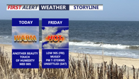
Delmarva will see a mostly sunny and seasonably warm day today, with inland highs in the mid 80s and cooler conditions along the coast. A slow-moving cold front will bring increasing chances for showers and thunderstorms late Friday into Saturday before drier weather returns Sunday. Heat and humidity are expected to build again by the middle and latter part of next week.

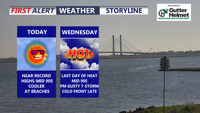
Delmarva will stay hot, sunny and dry today as southwest winds continue to push early-season heat into the region. Georgetown could approach or break a daily record high, while Delaware beaches will remain cooler but breezy. A Code Orange Air Quality Alert is in effect for Delaware today through Wednesday, and there is a moderate risk of dangerous rip currents at Delaware beaches. One more very hot day is expected Wednesday before a cold front brings showers and thunderstorms, with isolated strong to severe storms possible. Cooler, unsettled weather is expected late week into Memorial Day weekend.


Delmarva is heading into a stretch of summer-like heat beginning today, with highs climbing into the low to mid 90s inland and cooler 70s and 80s at the beaches. Near-record temperatures are possible through Wednesday before a cold front brings showers, storms and more seasonable air late week.

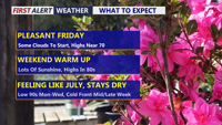
Delmarva will enjoy a mostly sunny and pleasant Friday with highs in the upper 60s to low 70s before a warming trend takes hold this weekend. Temperatures will climb into the upper 70s and low 80s Saturday, then surge into the mid 80s to low 90s from Sunday through the middle of next week. Mostly dry weather is expected through the next several days, though isolated showers or storms are possible Sunday and a better chance of showers and thunderstorms arrives late Wednesday into Thursday as a cold front brings temperatures closer to normal.

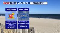
Delmarva faces moderate coastal flooding Friday evening as we deal with residual impacts of Hurricane Erin, with warnings in effect through early Saturday. Skies will clear overnight with lows in the 50s inland and low 60s near the coast. Saturday brings sunshine and highs in the low to mid 80s, followed by rising humidity ahead of a cold front Sunday into Monday that could spark scattered showers and thunderstorms. Cooler, drier air returns by midweek, with highs in the 70s and lows in the 50s.

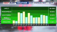
Sunday will deliver more summer warmth across Delmarva with highs in the 80s and only isolated thunderstorm chances. However, a cold front approaching Sunday night will trigger scattered showers and thunderstorms into early next week, followed by additional unsettled weather as stalled fronts linger and another system nears by the weekend.