



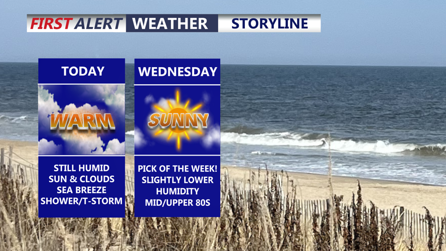

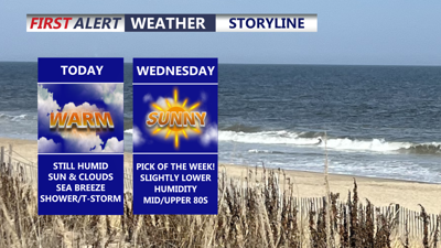
DELMARVA -- A weak cold front will gradually move south across Delmarva today bringing a slight drop in humidity along with the chance for a few isolated afternoon showers and thunderstorms mainly with the sea breeze this afternoon.

Can't completely rule out an isolated shower/t-storm this afternoon.
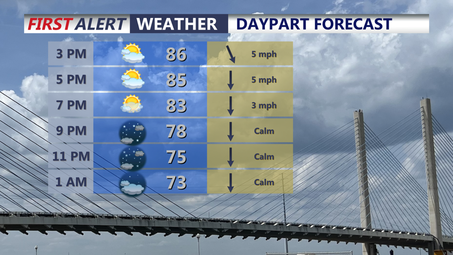
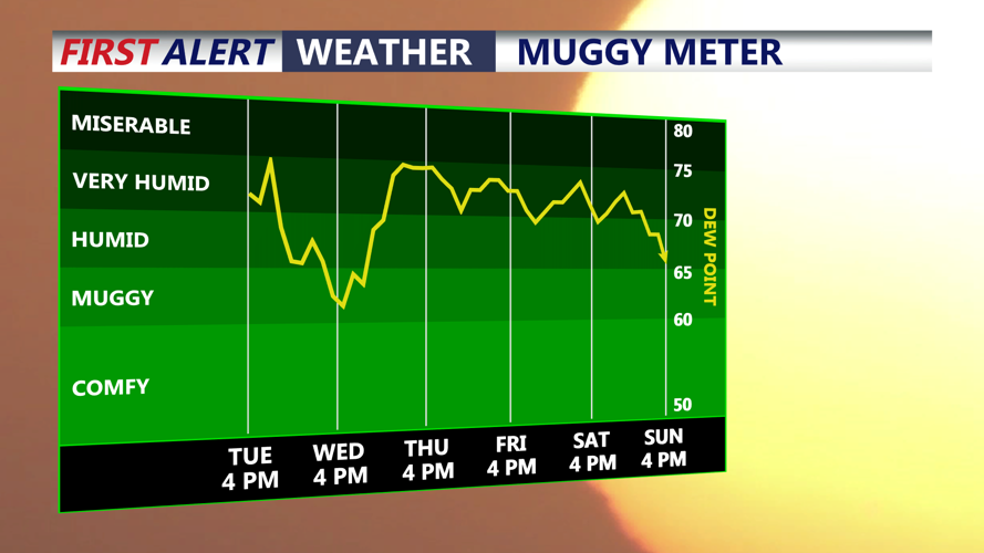
Most of the day is expected to remain dry, with high temperatures generally reaching the mid to upper 80s. Dew points should come down slightly behind the front, making conditions feel somewhat more comfortable than Monday despite similar temperatures.

Humidity levels drop slightly today into Wednesday.
The best opportunity for showers or thunderstorms will come during the afternoon and early evening as daytime heating combines with the nearby frontal boundary. Storm coverage is expected to remain isolated, and aside from lightning and brief downpours, widespread hazardous weather is not anticipated.

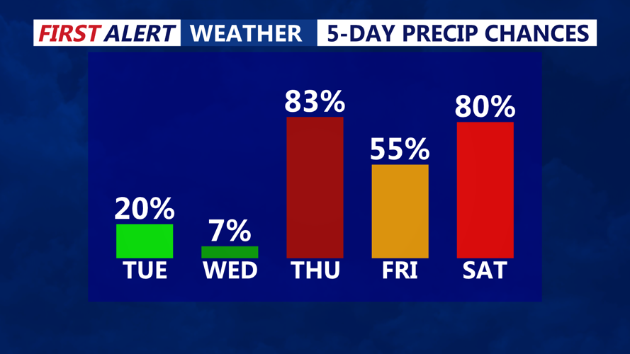
Isolated shower possible today, better chance Thursday - Saturday.
Any thunderstorms that develop should fade after sunset, leaving Delmarva mainly dry overnight. Patchy fog could form late tonight into early Wednesday, particularly in rural areas and locations that receive rainfall. Lows in the upper 60s.
Wednesday is expected to be the quietest weather day of the week. Pick of the week! Sunshine mixed with some clouds will accompany seasonable temperatures, with highs again reaching the mid to upper 80s. Humidity should remain lower for much of the day.
Conditions begin to change again late Wednesday into Thursday as another cold front approaches Delmarva. Shower and thunderstorm chances will increase Thursday, although uncertainty remains regarding exactly when the front will move through.
A slower-moving front could allow storms to develop during the warmer part of the day Thursday, potentially increasing the threat for locally heavy rainfall. Forecast confidence remains too low at this point to determine whether severe thunderstorms or flash flooding will become significant concerns, but Thursday will be a day to watch as newer forecast information becomes available. The Storm Prediction Center does have Sussex County and points to the south in a MARGINAL (1 of 5 ) severe risk.
The front may then slow down or stall near or just south of Delmarva heading into Friday and the weekend. That could keep the region in an unsettled pattern, with daily chances for showers and thunderstorms, particularly during the afternoon and evening hours.
Cloud cover and increased rain chances should help hold temperatures down later in the week. Highs from Thursday through the weekend are generally expected to range from the upper 70s to mid 80s, while overnight lows fall into the mid 60s. Humidity will also increase again as the wetter pattern develops.
For Delmarva, the overall trend is for scattered storm chances today, a quieter Wednesday, then a greater chance for showers and thunderstorms beginning Thursday and potentially continuing through the weekend.
