


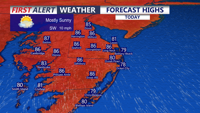


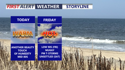
DELMARVA -- Will enjoy a seasonably warm day today under mostly sunny skies. Afternoon highs will reach the mid 80s inland, while coastal communities remain a bit cooler, generally in the upper 70s to low 80s. Winds will be breezy along the coast, with southerly gusts up to 25 mph.
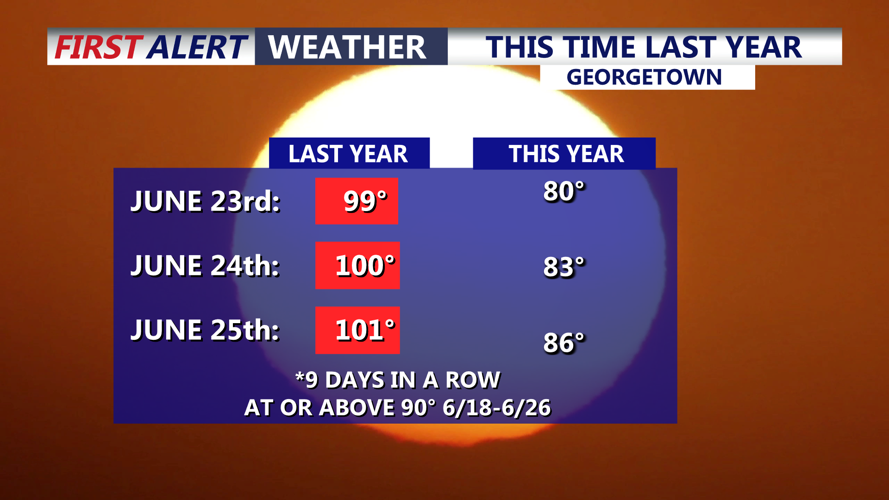
What a difference a year makes, this time last year we were in the midst of record setting warm including two straight days of triple digit highs.

This time last year we were in the midst of record breaking triple digit temperatures.

Seasonable temperatures today, upper 70s low 80s at the beaches. Winds will gust at the coast to 25 mph.
Tonight will be partly cloudy, mild, and muggy, with overnight lows falling into the upper 60s to low 70s across the peninsula.
Friday will turn hotter and more humid across Delmarva. Skies will be partly sunny, with highs climbing into the low 90s for many inland locations. A few isolated showers or thunderstorms may develop by Friday evening as unsettled weather begins to approach the region.
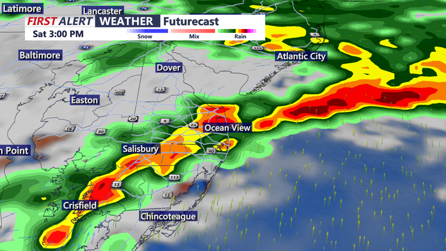
A cold front will slowly move through Delmarva late Friday into Saturday, bringing a better chance for showers and thunderstorms. Rain chances may begin as early as this evening in some spots, but coverage is expected to increase late Friday evening into Friday night as the front gradually sags southeast. Scattered showers and storms will remain possible through Saturday as the front slowly clears the region by late Saturday night.

Scattered showers and thunderstorms on Saturday.
Drier weather returns Sunday, with precipitation chances diminishing across Delmarva. Sunday looks partly cloudy, with highs generally in the mid 80s.
Looking ahead to next week, heat will begin building back into the region by midweek. Confidence is increasing that a strong ridge of high pressure will develop from the Great Lakes into the Mid-Atlantic and Northeast. As a result, heat index values in the 90s to near 100 degrees will be possible across Delmarva during the second half of next week.
