



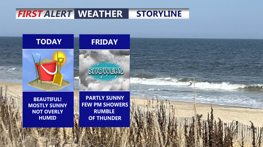
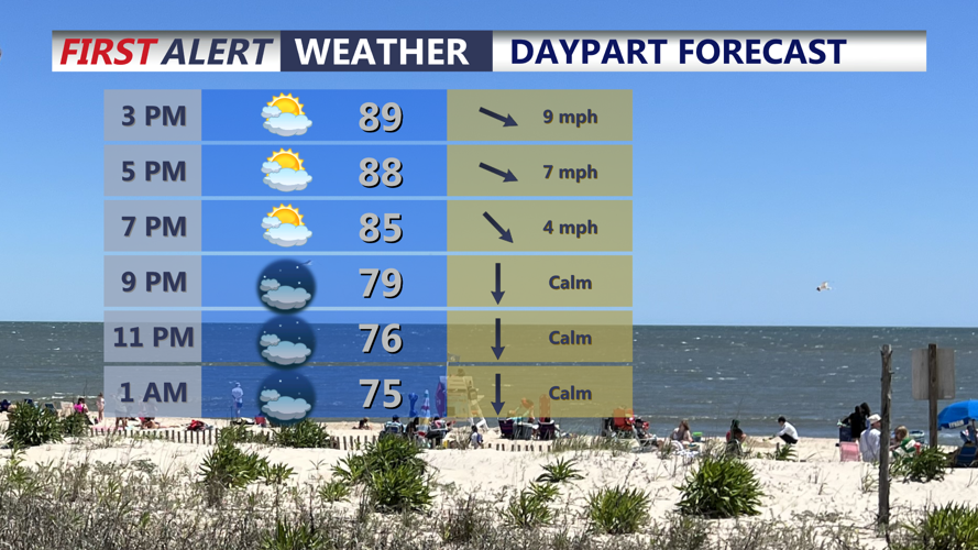

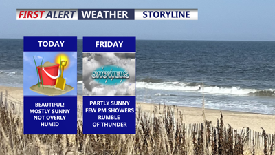
DELMARVA -- A beautiful summer day is on tap across Delmarva today, with hazy sunshine and temperatures climbing into the upper 80s to low 90s. Along the beaches, a sea breeze will develop during the day, helping keep coastal locations a little more comfortable compared with areas farther inland.

Hazy sunshine, warm and humid highs 87 to 92 with winds out of the west northwest 5 to 10 mph.
Tonight will feature partly cloudy skies with temperatures falling into the upper 60s to low 70s.

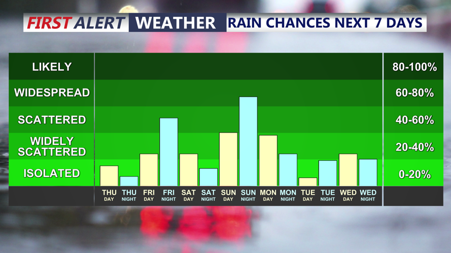
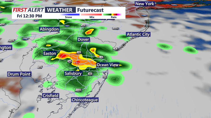
Scattered showers and a rumble of thunder Friday, then another chance for shower and thunderstorms arrives late Sunday.
A cold front will continue slowly sinking south through Delmarva into Friday, gradually bringing improving conditions to the region. Friday will feature partly sunny skies with highs mainly in the mid 80s. Cooler temperatures and lower humidity will become more noticeable as the day progresses, although the biggest improvement arrives Saturday.
A few showers will remain possible Friday afternoon into the evening as the front finally pushes far enough south to allow high pressure to build into Delmarva.

A cold front will swing through Friday, bring the chance of scattered showers and a rumble of thunder.
Saturday is shaping up to be the best weather day of the weekend. High pressure will be overhead, producing the driest, coolest and least humid conditions of the period. High temperatures will range from the upper 70s to mid 80s, with noticeably more comfortable humidity levels.
High pressure will remain in control through the first half of Sunday, keeping the morning largely dry. Conditions will begin changing later in the day as the high shifts offshore and southerly winds return. Temperatures will climb back into the mid to upper 80s while humidity increases.
Rain chances will return Sunday afternoon as the next storm system approaches the Mid-Atlantic.
Showers and thunderstorms will become more likely Sunday afternoon into Monday as low pressure moves toward the region. The atmosphere is expected to become very moist, increasing the possibility of heavy downpours within thunderstorms.
There may also be enough instability for a few stronger storms, but it remains too early to determine the exact severe weather or flash flooding threat for Delmarva. The potential will need to be monitored as the system gets closer.
Along the Delaware coast, spotty minor tidal flooding will be possible during Thursday evening’s high tide. Astronomical tides remain elevated following Wednesday’s New Moon, bringing water levels close to minor flooding thresholds in some locations along the Atlantic coast and Delaware Bay.
Tides are expected to gradually trend lower as the region moves farther away from the New Moon. At this time, only spotty minor flooding is expected. Tidal flooding is not currently forecast along the Eastern Shore of the Chesapeake Bay.
Overall, Delmarva will enjoy a hot but pleasant Thursday before a cold front ushers in cooler and less humid weather. Saturday remains the standout day of the weekend, with comfortable conditions continuing into early Sunday before humidity, showers and thunderstorms return later Sunday into Monday.
