





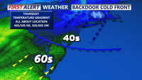
A stalled front keeps Delmarva dreary and foggy today, with the coolest, foggiest weather hugging the coast while inland areas briefly break into sunshine and warmer temperatures. Fog and drizzle linger into tonight and early Friday, then a backdoor cold front reinforces cooler, cloudier conditions. The pattern flips this weekend as warmer air pushes back in, turning noticeably milder Sunday and especially early next week with a few chances for showers and even a thunderstorm.
From
To

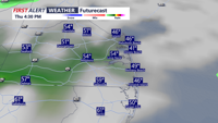
Low clouds, leftover fog and a few showers early Thursday give way to a damp, gray stretch into Friday morning.

Patchy fog and drizzle early Thursday should gradually transition to periods of steadier rain Thursday night into early Friday, with mainly wet — not wintry — impacts expected in Sussex County.

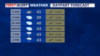
Patchy fog with light rain and drizzle is expected late Wednesday into Thursday morning in Sussex County, with murky travel at times.

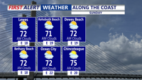
Sunday’s weather will be similar to Saturday's, with high pressure drifting slightly southeast. This will maintain an onshore flow and the possibility of an isolated shower near the coast.

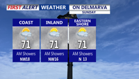
A stalled front and weak low pressure system will keep clouds and scattered showers over Delmarva Sunday, with highs only in the low to mid-70s. Conditions improve Sunday night as high pressure builds in, bringing dry and seasonable weather to start the week. A weak coastal low could bring more clouds midweek, while a warm, dry Thursday is followed by another cool and comfortable weekend.

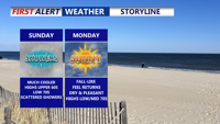
Clouds and scattered showers linger across Delmarva Sunday as a nearly stationary front and weak low pressure system pass through the region. Highs will remain cool, in the low 70s, before conditions clear late in the day. Dry weather and seasonable temperatures return Sunday night into Monday, with partly sunny skies and highs in the mid-70s. A weak coastal low could increase cloud cover Tuesday into Wednesday, followed by a stretch of dry, pleasant weather for the latter half of the week.

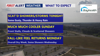
Scattered showers and thunderstorms will move across Delmarva Saturday evening, with the severe threat ending after 9 p.m. Some storms could still bring gusty winds, heavy rainfall, and localized flash flooding before overnight lows dip into the low to mid-60s. Much cooler air arrives Sunday as highs hold in the 60s, with a stalled front keeping scattered showers in the forecast. Skies will clear Sunday night, with lows in the mid-50s. Sunshine returns Monday with pleasant highs in the low to mid-70s, though clouds will increase Monday night as a weak coastal low approaches.

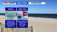
High pressure to the north and a stalled boundary to the south will keep Delmarva cloudy, cool, and unsettled through midweek. Hurricane Erin will make its closest pass offshore Thursday, bringing dangerous rip currents, high surf, and gusty winds along the coast. Inland areas will see scattered showers and below-normal temperatures before calmer, drier weather returns late week.


Delmarva will notice a big change in the weather starting Sunday night as a cold front sweeps across the region. The front is expected to pass from northwest to southeast late Sunday evening into the overnight hours, followed by a shift in winds from the southwest to the north and northeast. Low clouds are likely to form, with overnight lows dropping into the upper 60s to lower 70s by Monday morning.