


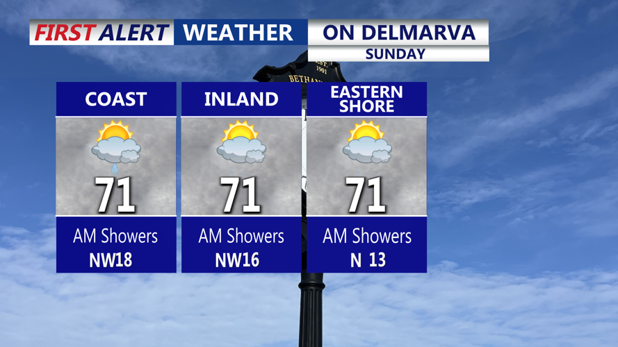


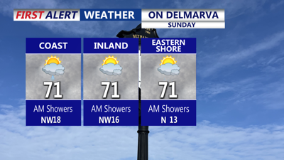
DELMARVA -- Clouds and scattered showers will linger across Delmarva Sunday as a nearly stationary front and weak low pressure system move through the region.

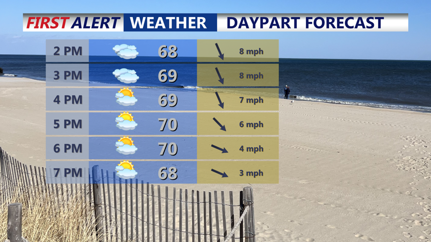
Cloudy skies give way to gradual clearing into the evening.
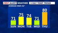
Unsettled weather will hold through much of the day, before gradually clearing later in the afternoon. Cooler air will settle in, keeping high temperatures in the low 70s, a sharp contrast to the heat earlier in the week.

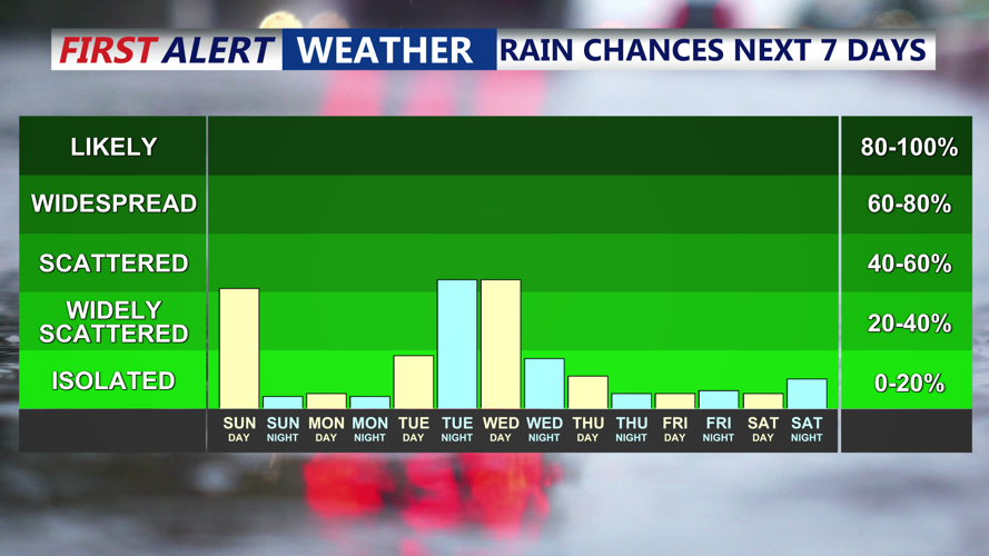
It should stay mostly dry over the next 7 days, with small shower chances today and late Tuesday-Wednesday.
By Sunday night, the front will depart to the east as high pressure builds in from the Midwest and Great Lakes. Conditions will turn dry and comfortable with overnight lows in the low to mid-50s.

Temperatures stay below average, warmest day being Thursday.
Monday is expected to bring mostly sunny skies and highs in the mid-70s. Clouds will increase Monday night as a weak coastal low approaches, particularly near the shoreline, but the region should remain dry with lows in the mid-50s.
Tuesday will be partly cloudy and seasonable, with highs in the mid-70s. Depending on the track of the coastal low, a few showers may be possible Tuesday night, though most of the region is expected to remain dry. Clouds are likely to linger through Wednesday, keeping highs in the low 70s, before clearing slowly that night.
The end of the week looks pleasant. Thursday should be the warmest day of the stretch with highs in the low 80s. A dry cold front will sweep through late in the week, bringing cooler, comfortable conditions into the weekend as high pressure once again settles over the region.
