


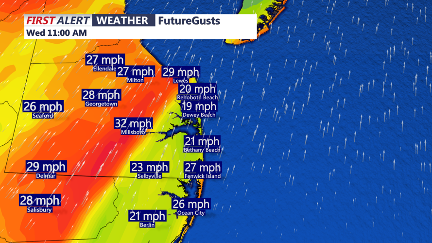


DELMARVA - A wetter pattern will move into Sussex County early Wednesday, bringing increasing clouds, breezy conditions and periods of showers through Wednesday night.
Cold front approaching from the Great Lakes will move toward the Mid-Atlantic, with showers beginning Wednesday and the steadiest rain arriving later in the day. The front is forecast to slow or stall near the region, allowing another area of low pressure to develop to the south and move toward the coast.
In Georgetown, Wednesday is forecast to be mostly cloudy, breezy and cooler than Tuesday, with a high near 75 degrees. A couple of showers may begin around midday, with rain chances continuing through Wednesday evening and overnight.
The rain is not expected to bring major impacts. Forecasters say instability should remain low, keeping the threat for severe weather and flooding limited. An isolated thunderstorm is possible, but most rainfall should be beneficial for the area.
By early Thursday morning, clouds and scattered showers may linger across Sussex County as the stalled front remains nearby. Temperatures are expected to fall into the mid-50s overnight before cooler, breezy conditions continue Thursday.
