


DELMARVA- Another round of patchy frost is possible Sunday morning, with a cool and somewhat cloudy end to the weekend.

The chill comes courtesy of surface high pressure anchored over eastern Canada, which will continue to control the weather through the weekend.
This evening expect partly cloudy and chilly conditions with temperatures falling through the 50s, then into the 40s. Overnight some inland spots could see a touch of frost, especially where the clouds are thinner. Lows in the 30s and 40s.

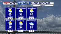
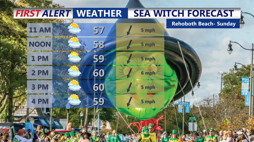
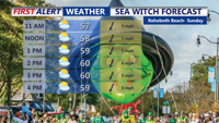
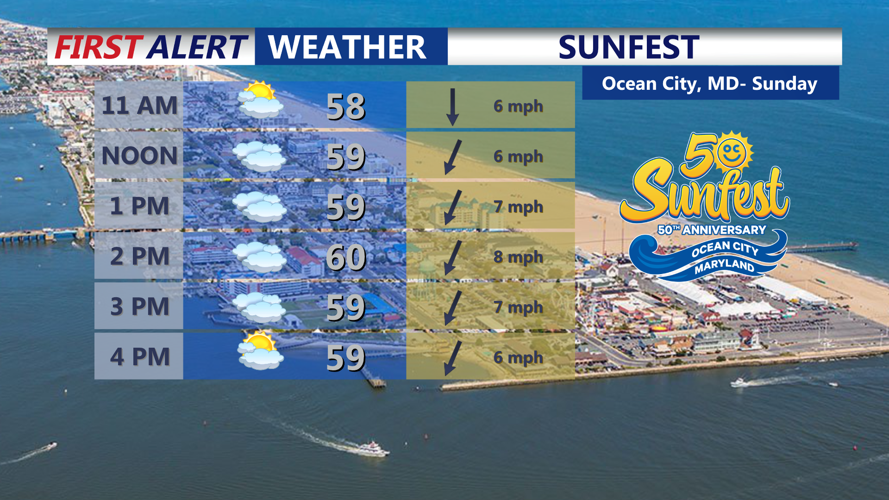
Sunday will bring more tranquil conditions, though skies may turn partly to mostly cloudy at times. Highs will remain in the upper 50s to around 60 degrees. Looking great for Sea Witch and Sunfest. Sunday night lows will dip into the low and mid 40s.

Looking ahead to early next week, quiet and cool weather continues on Monday with highs in the 50s. However, the First Alert Weather team keeping an eye on a developing system that could bring a shift to our weather by midweek.

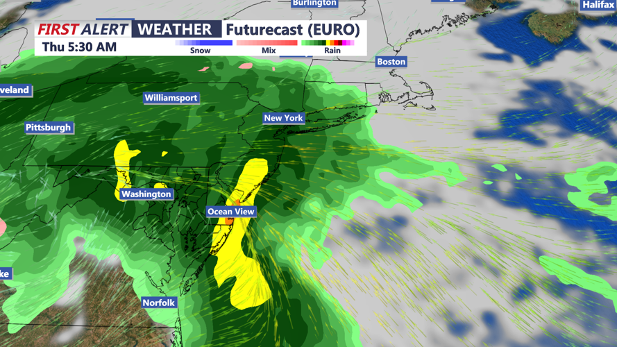
Low pressure may form somewhere along the Mid-Atlantic or Southeast coast between Wednesday and Thursday, potentially bringing periods of rain, some of it possibly heavy, along with gusty east to northeast winds and beach erosion.
While details remain uncertain, the chance for unsettled weather increases midweek. Temperatures are expected to stay below normal throughout this stretch.