


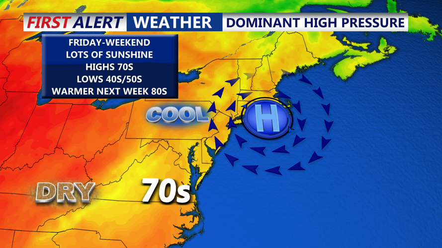


DELMARVA -- High pressure centered over southern Quebec is building south into the mid-Atlantic, setting up several days of dry and tranquil weather. Skies will remain mostly clear to partly cloudy through Friday, with light east to northeast winds around 5 to 10 mph inland and gusts up to 25 mph along the coast.

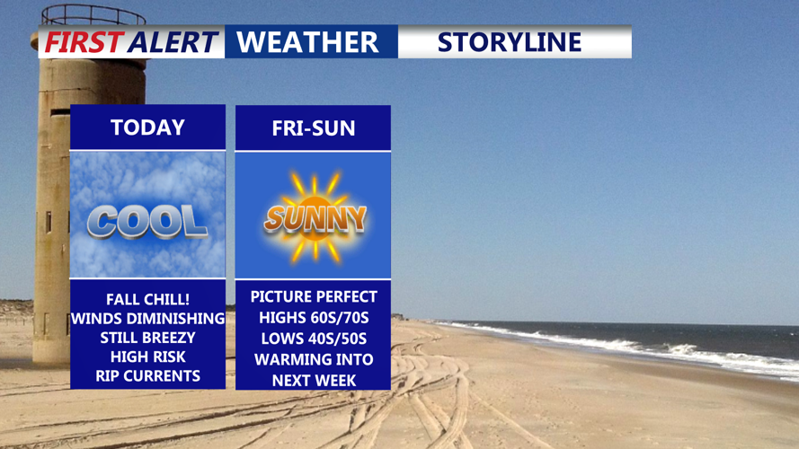
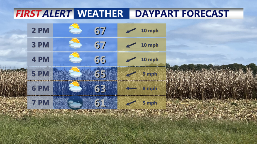
Partly cloudy skies on Delmarva, breezy at the beaches, highs 66 to 71, falling into the 40s away from the coast tonight.
Highs will reach the upper 60s to near 70 before dropping into the low to mid 40s away from the coast to low to mid 50 at the coast overnight.

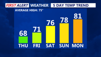
Average temperatures to start the weekend, pushing back into the 80s into early next week.
The cool airmass will begin to moderate Friday, with afternoon highs climbing back into the upper 60s to low 70s. Nights will remain on the chilly side, with lows in the upper 40s to mid-50s. High pressure will continue to dominate through the weekend, bringing mostly sunny skies Saturday and highs in the mid- to upper 70s. Clear nights Friday and Saturday will keep lows in the 50s. Absolutely perfect weekend, setting the stage for a great time at Country Calling in Ocean City, MD this weekend.

High pressure will dominate our weather pattern in the weekend through early next week.
Looking ahead, the fair weather extends into Sunday and Monday as high pressure shifts offshore but continues to influence the region. Both days will feature abundant sunshine and highs in the 70s, with overnight lows in the 50s.
By Tuesday, an upper-level trough moving out of Canada will push a cold front toward the region. Clouds will increase during the day, with a slight chance of isolated showers by afternoon and evening. The best chance of scattered showers arrives Tuesday night into Wednesday as the front moves through. Temperatures will stay mild, with highs both days in the upper 70s to 80s.