


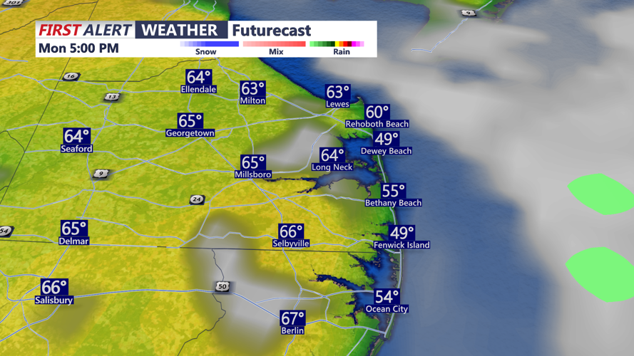


DELMARVA - This morning, expect skies to gradually clear with areas of fog. Some of the fog could be dense. Temperatures will be in the 40s, with some 50s at the coast.
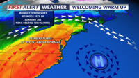
Much of Delmarva will be sitting in a much milder pattern to start the week, with highs reaching the upper 60s to low 70s later Monday. Springlike warmth takes hold across the peninsula early to mid week as high pressure offshore, and a south to southwest wind bring a warmer air mass into the region. Highs are expected to push into the low to mid 70s by Tuesday and Wednesday for many inland areas. Coastal locations may stay cooler at times, especially if a sea breeze develops and moves inland. Georgetown could come close to a record high on Wednesday.
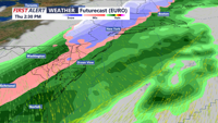
Changes come beginning late Wednesday, as a strong cold front moves into the eastern US. As the cold front approaches the region on Thursday, winds will increase, with rain likely. It's possible enough cold air gets involved at the end to change the rain to wet snow. It's looking like a low chance at this point. Behind that system, temperatures turn cooler again Friday, but not especially cold. Highs will be in the 50s with breezy conditions.
