


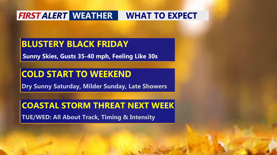


DELMARVA -- An extended stretch of cold weather as a series of systems moves across the Mid-Atlantic. Today’s Black Friday is blustery and brisk, with mostly sunny skies and highs in the low 40s. Strong westerly winds, gusting between 30 and 40 mph, will push wind chills into the lower 30s through the afternoon.
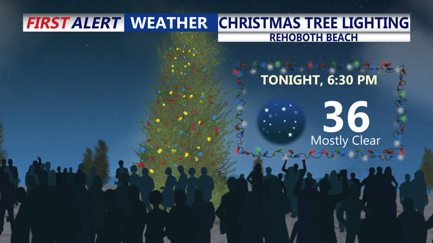
Big night in Rehoboth Beach, grab the hot chocolate and marshmallows as we kick of the Christmas season with the Christmas tree lighting.

Big night in Rehoboth Beach, it will feel more like the upper 20s with the wind chill.
Tonight expect starry skies, winds will relax as temperatures fall into the low to mid 20s.
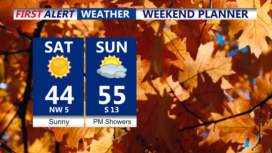
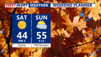
High pressure sliding in from the Plains will settle over the East Coast on Saturday, keeping conditions dry but still colder than normal. Highs will remain in the low to mid-40s, though easing winds will make the day feel less harsh compared to Friday. Increasing clouds Saturday night will help hold overnight temperatures in the mid-20s to around 30 degrees.

Cold dry start to the weekend, not as windy, southerly winds return Sunday warming up to the 50s ahead of a cold front that will bring late showers.
A developing low moving out of the Midwest will bring mostly light rain to Delmarva on Sunday. Rainfall totals are expected to range from 0.10 to 0.25 inches as the system tracks toward the Great Lakes, placing the region on the warm side of the storm. Temperatures will climb into the low to mid-50s before a cold front moves offshore late Sunday. Southwest winds of 10 to 20 mph may gust up to 30 mph during the afternoon. By early Monday, temperatures will drop back to around freezing.
Another shot of cold, dry air arrives Monday, bringing highs in the mid-40s and another breezy day across the peninsula. Overnight lows Monday night will fall once again near 30 degrees.
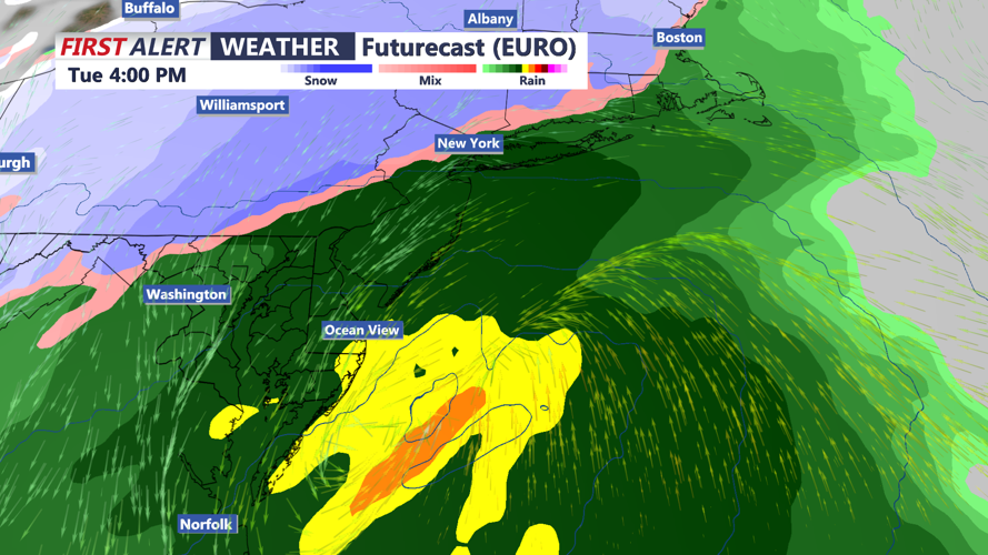
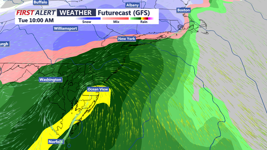
Attention then turns to a coastal low forecast to approach on Tuesday. While confidence remains low regarding the storm’s strength and track, the system may bring widespread precipitation.

Potential coastal storm could impact the region Tuesday. All about track, intensity and timing. Right now it looks like rain, snow looks to stay north and west of I-95.
Areas along the coast currently appear most likely to see mainly rain, while inland regions—particularly northwest of the I-95 corridor and well off the beaches—could see a brief period of snow or a rain-snow mix at onset due to the cold air already in place. Any shift in the storm track could alter precipitation types and impacts.

GFS also has a warmer solution with rain and wind for Delmarva.
The system will move out Tuesday night, with dry and cold weather returning for Wednesday and Thursday as high pressure builds back into the region.