


DELMARVA - Breezy and dry conditions will continue into late Tuesday evening across inland Sussex County, keeping a limited fire weather risk in place before a wetter pattern arrives Wednesday.
South to southwest winds are expected to remain around 15 to 20 mph, with gusts up to 25 to 30 mph. Relative humidity values have fallen to about 25% to 35% in many areas, and dry fuels may support faster fire spread, especially away from the immediate coast. The forecast for Georgetown calls for a warm, windy Tuesday with elevated wildfire risk tied to gusty winds, low humidity and dry brush.
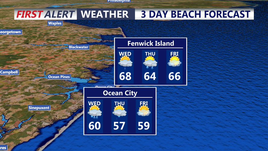
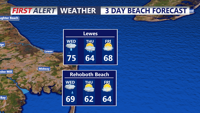
Conditions will turn cloudier overnight as a cold front approaches from the west. Showers are expected to begin moving into the area Wednesday morning, but the steadier rain is forecast to arrive later Wednesday and continue into Wednesday evening as the front slows near the Mid-Atlantic coast.
Rainfall should be mostly beneficial, with limited instability and little to no severe weather or flooding threat. An isolated thunderstorm cannot be ruled out. Wednesday is expected to be mostly cloudy, breezy and cooler, with highs near the mid-70s in central Sussex County.
Additional showers may linger into Thursday as low pressure develops along the stalled front, followed by another chance for scattered showers Saturday. No significant impacts are expected with the weekend system at this time.
