


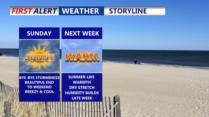


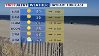

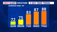


DELMARVA-- Will close out the weekend with bright skies, dry air, and comfortable conditions across Delmarva. High pressure continues to build into the Ohio Valley and will expand over the region later Monday through midweek. This pattern will bring stable weather for the start of June, with high temperatures on Sunday reaching the upper 60s to low 70s—below average for early summer. A light west wind around 10 to 15 mph may occasionally gust up to 30 mph.

Mostly sunny breezy Sunday on Delmarva.
By Sunday night, temperatures will again dip into the 40s across many inland areas, with warmer coastal spots holding in the 50s. The high-pressure system continues to move closer, positioning itself just south of the area by early Tuesday. This setup keeps most of Delmarva dry, although some clouds may develop in the afternoon hours on Monday due to a lingering upper-level trough.

Temperatures gradually warming well above average next week.
Temperatures will begin a slow rise starting Monday, with daytime highs returning solidly to the mid 70s for most of the region, including near the beaches and higher elevations. Monday night’s lows are expected to stay mainly in the 50s.

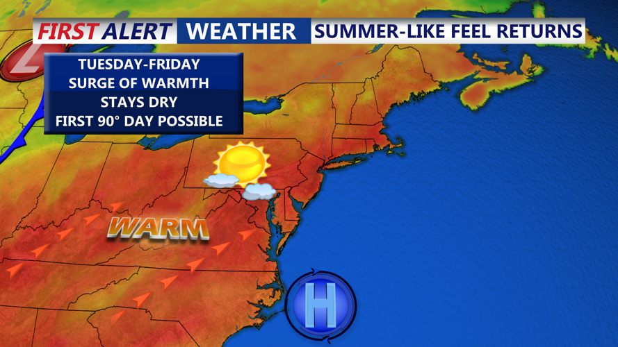
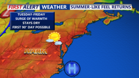
Our first 90 degree day is growing more likely into late next week.
The second half of the week will bring a more summer-like pattern. A ridge of high pressure will shift off the coast into a classic Bermuda position, drawing warmer air into the region. Tuesday’s highs will reach the low to mid-80s, followed by upper 80s Wednesday and potentially the first 90-degree day of the year on Thursday.
Nighttime temperatures will rise as well, with lows near 60 degrees Tuesday night, into the mid-60s Wednesday night, and potentially around 70 degrees Thursday night. A cold front may approach by Friday, bringing a slight chance for showers and thunderstorms, but overall, the long-term outlook remains dry and warm for Delmarva.