


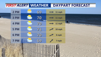


DELMARVA -- Sunday afternoon is delivering a picture-perfect end to the weekend on Delmarva. Under mostly sunny skies, temperatures remain on the cool side for early June, reaching the upper 60s to low 70s across the region. Despite the sunshine, west winds brought a noticeable breeze, averaging 10 to 15 mph and occasionally gusting up to 30 mph.

Partly cloudy breezy afternoon with give way to a pleasant evening on Delmarva.
The stretch of dry, pleasant weather continues into Sunday night as high pressure strengthens and slides eastward from the Ohio Valley. Lows tonight will fall into the 40s for many inland locations, with the warmest coastal spots holding in the low 50s—still reminiscent of mid-April rather than early summer.
On Monday, the warming trend begins. High temperatures are expected to climb into the low to mid-70s across much of Delmarva, including along the coast and even into the higher elevations. While clouds may drift in during the afternoon hours due to a lingering upper-level trough, the day should remain dry. A weak disturbance could attempt to trigger a few showers Monday night, but most guidance suggests the region will stay quiet. Overnight lows Monday night will be a bit milder, generally in the 50s.

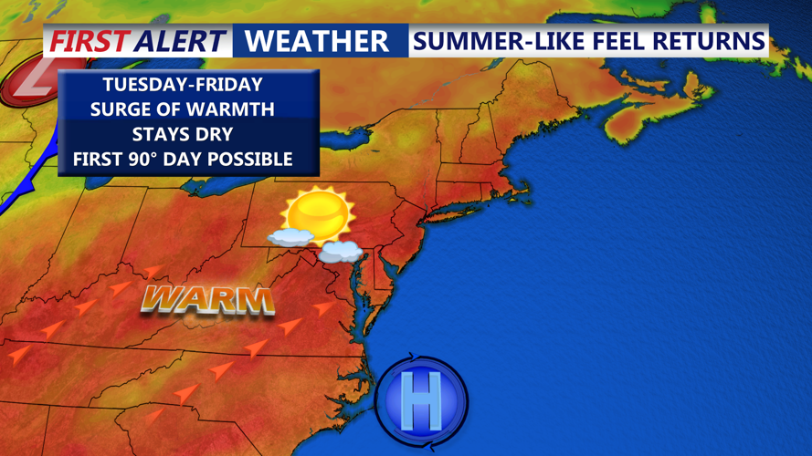
Classic summer-like setup, warmer temperatures and increasing humidity by late week.
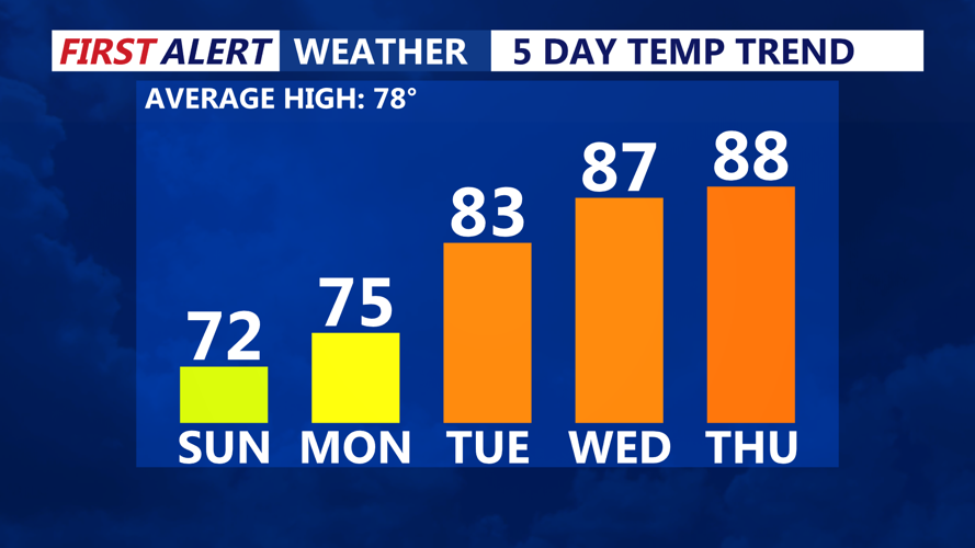
Looking ahead, the weather pattern shifts to a more summer-like setup by Tuesday. A strong upper ridge and high pressure settling in offshore will position Delmarva under a warming influence. Temperatures will rise to the low to mid-80s Tuesday, reach the upper 80s Wednesday, and potentially hit 90 degrees on Thursday—marking what could be the first 90-degree day of the season.
Nighttime temperatures will trend upward as well, with lows near 60 Tuesday night, rising to the mid-60s Wednesday night, and possibly staying near 70 Thursday night. A cold front may move into the region by Friday, bringing a slight chance of showers or thunderstorms, but overall the long-term outlook remains mostly dry.