


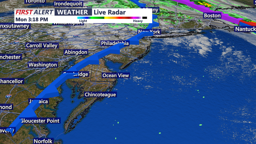


DELMARVA - High pressure building across the Southeast will bring a brief period of calmer weather to Sussex County late Monday evening into Tuesday before another round of unsettled weather arrives midweek.
On Tuesday, winds will shift from the southwest and strengthen again ahead of an approaching cold front. Increasing clouds will accompany a warming trend, with temperatures climbing near 70 degrees. Rain is unlikely during the day but could develop after sunset as the front nears.
The cold front will cross the region Tuesday night into Wednesday morning, bringing isolated to scattered showers with light rainfall accumulation. As low pressure intensifies near the Great Lakes, gusty northwest winds of 20 to 25 mph are expected by Wednesday afternoon, ushering in cooler air. Highs will range from the mid-50s to mid-60s, and skies will clear by Wednesday night with temperatures falling into the 40s.
Thursday will be partly to mostly sunny as a weaker secondary front sweeps through, possibly triggering a spotty shower, especially in northern and western parts of the county. Highs will stay in the upper 50s to low 60s as cooler air settles in.
High pressure will return Friday and Saturday, bringing dry, breezy, and sunny conditions to end the workweek. By Sunday into early next week, forecast models show the potential for another system to move through, though details remain uncertain.
