


DELMARVA -- A brief break from harsh winter weather arrives on Delmarva today as high pressure builds into the region, bringing lighter winds, some sunshine and slightly warmer temperatures compared to Thursday. Winds are expected to remain in the 10 to 15 mph range, making conditions feel noticeably less brutal than recent days. Clouds will gradually increase tonight as a weak warm front approaches.

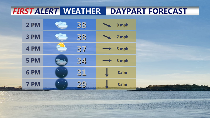
Partly sunny skies, highs in the upper 30s, high clouds clear out through the evening.
Saturday is expected to remain quiet but chilly, with below-average temperatures and increasing cloud cover through the day and evening. Highs will reach the mid 40s.

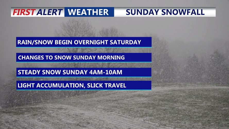
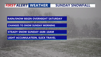
Brief period of snow late Saturday night - Sunday morning, snow will exit the coast by midday. Arctic front pushes through during the day.
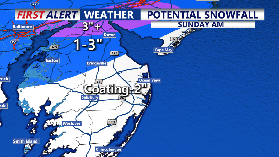
Conditions change late Saturday night into Sunday morning as an arctic front sweeps across Delmarva, bringing a quick-moving snow event. YELLOW ALERT Sunday morning. Current forecasts call for widespread snowfall totals of 1 to 3 inches, with localized amounts up to 4 inches possible, primarily north of Kent County, DE. Coating to 1 inch from Lewes, down the Delaware coast into Ocean City, MD. Some areas could briefly see rain or a rain-snow mix before changing to all snow.

Coating to 2 inches of snow from Sussex County to the southern mid shore on south, up to 3" possible mid shore Kent County, DE on northward.
Snow tapers Sunday as arctic air pours in on gusty west to northwest winds. Temperatures may struggle to rise during the day and could even fall by afternoon, leading to dangerous wind chills and areas of blowing snow. Sunday night lows drop into the teens, with wind chills falling into the single digits.

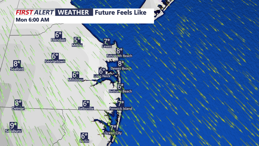
Biting wind chills will greet us by Monday morning, feeling more like the single digits Monday morning.
The coldest conditions linger into Monday with highs remaining below freezing and gusty winds continuing. Winds ease Tuesday as high pressure shifts south, allowing temperatures to slowly moderate. A noticeable warmup is expected by midweek, with much milder air pushing into the region and highs potentially reaching the 50s by Thursday.
