


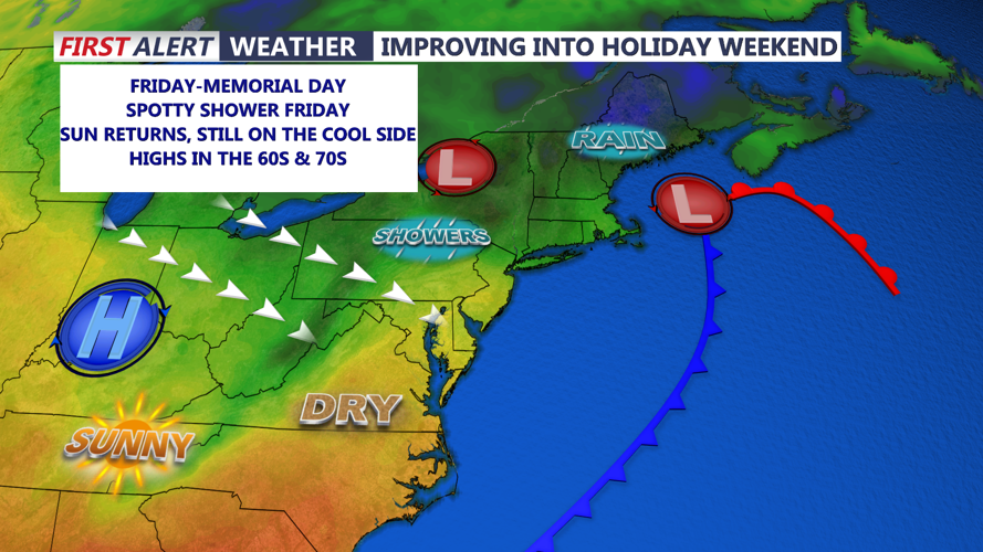


DELMARVA - Sussex County residents can expect a cooler and breezy stretch of weather from early Friday morning through early Sunday, as an expansive low-pressure system slowly shifts north and east, allowing drier air and more sunshine to return gradually over the weekend.
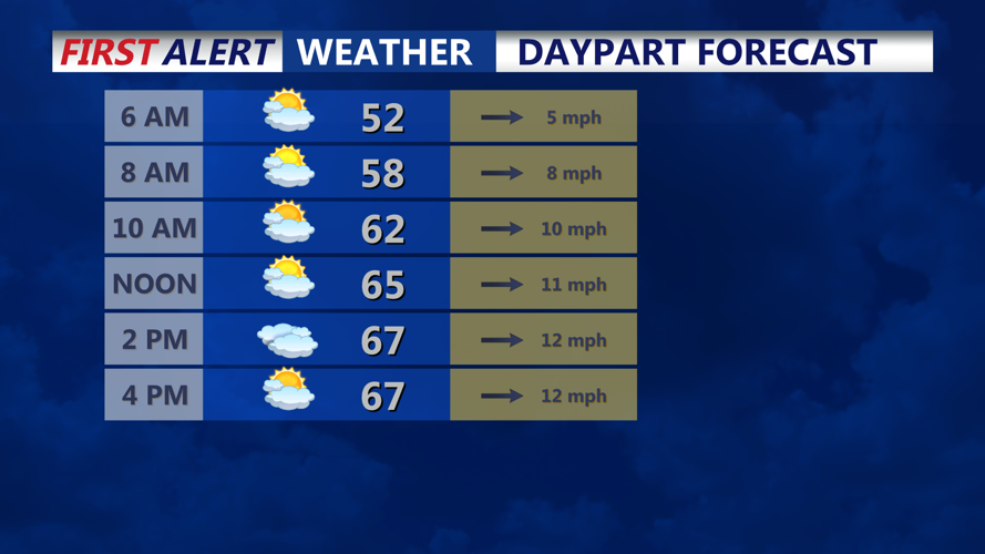
The day begins Friday under the influence of a slowly departing low that has brought unsettled weather to the Mid-Atlantic. The atmosphere remains unstable early in the day, and a shortwave disturbance may trigger scattered showers across the area during the afternoon. However, skies could briefly become partly sunny between showers. Temperatures will climb into the 60s to near 70 degrees by the afternoon.
Winds will be a noticeable feature through Friday, as the pressure gradient tightens behind the intensifying low now moving into New England. Sustained northwest winds around 15 mph will be accompanied by gusts reaching 25 mph at times, especially in exposed or coastal areas.
By Friday night, the low continues to lift further into northern New England and near Newfoundland. This will allow a drier trend to settle in across Sussex County. Clouds will decrease somewhat, though lingering moisture and the cool air mass may allow for patchy clouds overnight. Low temperatures will fall into the mid to upper 40s, continuing the recent pattern of below-normal overnight readings.
Saturday will bring more sunshine, particularly for areas south of the Mason-Dixon Line. While a few clouds may drift through as upper-level disturbances sweep across the Northeast, no significant precipitation is expected in Sussex County. The northwest breeze will persist, though slightly weaker than Friday, keeping daytime highs in the 60s.
Sunday’s outlook features the best conditions of the period. Winds will ease, and sunshine will be more widespread. Afternoon highs will reach the upper 60s to lower 70s under mostly sunny skies, making it a pleasant day across the region. Even beachgoers can expect similar temperatures thanks to a continued offshore flow, though water temperatures remain in the upper 50s.
Overnight lows will again dip into the 40s both Friday and Saturday nights, reinforcing the early autumn feel across the area. The calm and dry pattern is expected to persist into Monday before another system approaches midweek.
