


DELMARVA - The high-pressure system centered over southern Quebec will continue to keep skies mostly clear across the Delmarva region tonight. Winds will be light, and temperatures will be cool, with lows expected to range from the mid-30s inland to the low 40s along the coast. Some areas, especially near the coast, may see a few clouds developing due to a shift to an onshore flow.
Tuesday Early Morning:
As the high-pressure center gradually moves eastward, the onshore southeasterly flow will strengthen slightly, bringing increased humidity and slightly warmer conditions. Coastal areas may see some low clouds beginning to form. Morning lows will remain on the cool side, but temperatures will start to rise quickly after sunrise.
Tuesday Mid-Morning:
Cloud cover will increase as a warm front approaches from the west, bringing mid-level clouds across much of Delmarva. Coastal areas may experience additional lower clouds and even a few isolated sprinkles due to the onshore flow. Temperatures will begin to climb, reaching into the upper 50s to low 60s by mid-morning.
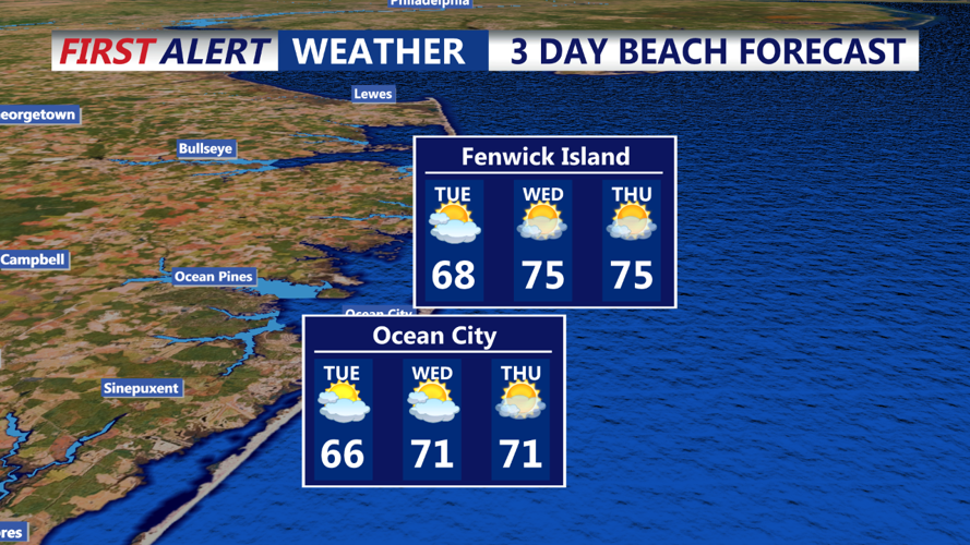
Tuesday Afternoon:
The warm front will continue to approach, resulting in mostly cloudy skies over Delmarva. While most areas will remain dry, there’s a slight chance of a few spotty showers, particularly near the coast and in the northern parts of the region. High temperatures will be warmer than Monday, with highs reaching the low to mid-60s in the northern areas and the upper 60s to around 70 degrees in southern Delmarva.