


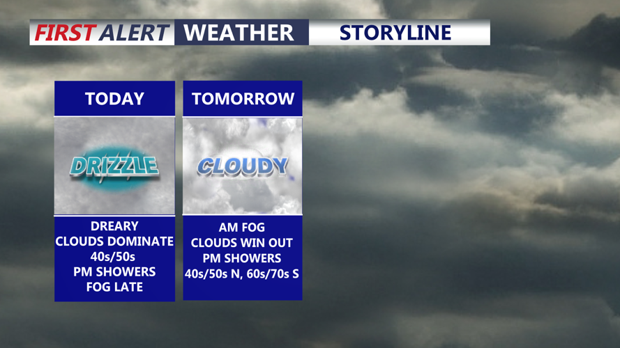


DELMARVA -- The peninsula remains locked in a gloomy pattern with widespread clouds, areas of fog, and occasional light showers or drizzle. A stationary front is positioned across the region, connected to low pressure over the Ohio Valley. As that low tracks north and east through the day, it will pull the front northward, allowing it to lift as a warm front. Temperatures will respond by trending upward slowly, including through tonight rather than falling sharply after sunset.

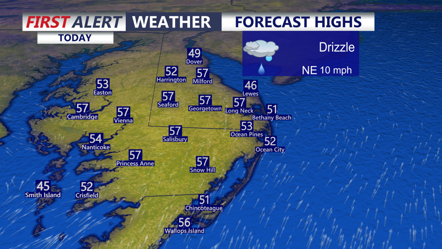
Highs at the coast upper 40s to low 50s, inland mid to upper 50s to near 60.
High temperatures today and into Thursday will generally reach the upper 40s to low 50s near the coast, with inland areas possibly climbing into the mid to upper 50s to near 60 in some spots. Tonight, expect more fog to develop with ceilings lowering again. Another shot of rain is possible late as the low draws closer. Overnight lows will generally hold in the 40s.

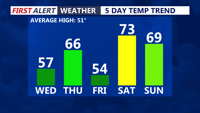
Temperatures all over the place through the weekend thanks to clouds and an easterly flow.
Looking ahead, brings a complicated setup that can keep Delmarva cooler and cloudier at times, especially Thursday into Friday. Thursday mostly cloudy skies, highs in the mid to upper 60s, cooler to the north in the 50s, warmer to the southwest in the 60s to near 70.

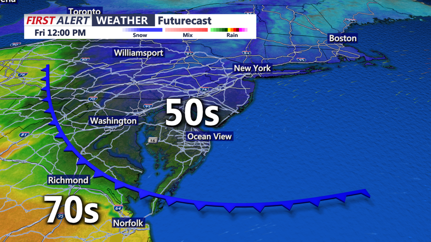
Backdoor cold front and clouds will delay our warm up on Friday.
As high pressure builds south out of eastern Canada, an onshore east to northeast flow may strengthen. That can wedge cooler air into the region, increase low clouds, and maintain areas of fog. This type of cold-air damming setup often creates sharp temperature differences across the peninsula, and it may keep some locations cooler than expected on Friday. The backdoor cold front will keep us cloudy and cool Friday, highs in the upper 40s to low 50s. The warmer temperatures will be on the other side of the bay.
Shower chances also increase late week. A passing disturbance aloft is expected to enhance lift and bring a bump in shower activity Thursday morning, with another round possible Thursday night. A few rumbles of thunder cannot be ruled out.
The bigger story is the turn to much milder weather. Another disturbance and trailing cold front could bring additional showers and a few thunderstorms Saturday night, but overall Delmarva becomes increasingly embedded in warmer air over the weekend and especially early next week. Highs from Saturday through Tuesday are forecast to rise into the 70s, with many areas pushing into the mid 70s as we head deeper into early next week. Along the coast, lighter winds and a more southerly flow could still allow for cooler readings at times due to marine influence and the potential for a sea breeze, but the overall trend remains noticeably warmer with several opportunities for showers.