


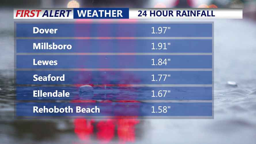


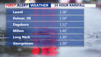


DELMARVA -- A slow-moving low pressure system off the New Jersey coast delivered a much-needed soaking rain across Delmarva Saturday, with some locations picking up nearly two inches of precipitation.

Rainfall totals across Southern Delaware
Millsboro recorded 1.91 inches, Lewes saw 1.84 inches, and Rehoboth Beach tallied 1.58 inches.

24 hour rainfall totals across Sussex County.
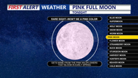
As the rain eases, residents can expect lingering cloudy and damp conditions Saturday night, along with areas of spotty drizzle. Temperatures will fall into the upper 30s to low 40s. Unfortunately, the persistent cloud cover will obscure the view of April’s full "Pink Moon"—named for spring-blooming wildflowers, not its actual color.

Unfortunately due to cloudy skies we won't see tonight's "Pink Moon"
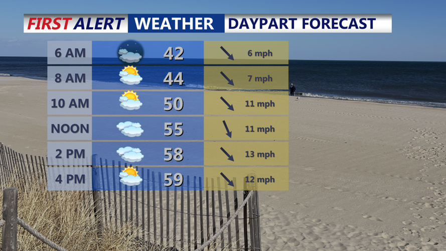
On Sunday, both surface and upper-level low pressure systems will shift northward into New England, allowing high pressure to gradually build in from the west. While the day will remain mostly cloudy, some breaks of sunshine are expected by afternoon, especially in southern parts of Delmarva. High temperatures will rise into the upper 50s to low 60s.

Will see sun break through the clouds Sunday, especially late in the afternoon.
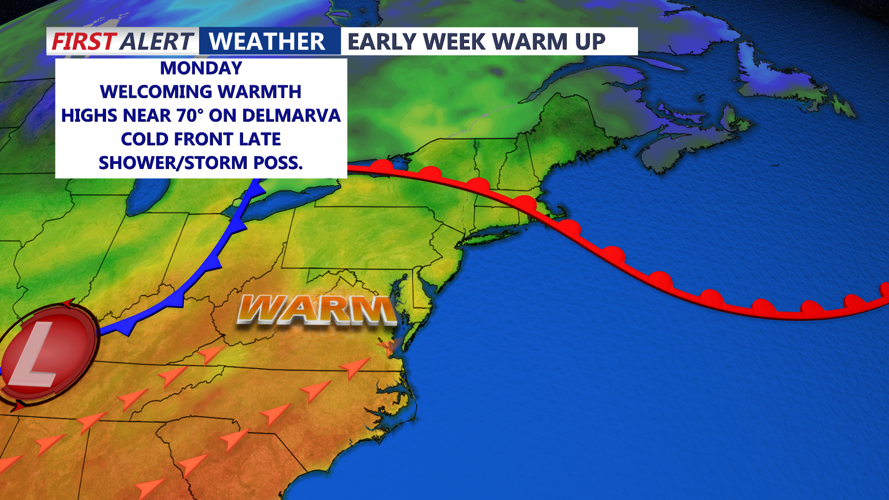
Sunday night turns quiet and chilly, with lows in the upper 30s to mid 40s. A warm front will lift north of the area early Monday, introducing a warmer air mass. Highs on Monday are forecast to reach the 60s and near 70 degrees in spots, though cloud cover will persist.

Temperature rising back into the upper 60s to 70 Monday ahead of a cold front.
By late Monday, a cold front will approach from the west, bringing the potential for scattered showers and isolated thunderstorms during the evening. Some models suggest limited instability, which may cap any severe threat. After the front clears, improving conditions are expected by daybreak Tuesday, with overnight lows in the mid 40s to mid 50s.
Tuesday will be breezy but mostly dry, with highs in the upper 50s to mid 60s under a mix of sun and clouds. Westerly winds may gust up to 35 mph in the afternoon.
Looking ahead, a secondary cold front will pass through Tuesday night, bringing cooler and drier air. From Wednesday through Friday, high pressure will dominate, yielding mostly sunny skies and cooler-than-normal temperatures. Overnight lows may dip enough to prompt frost or freeze concerns in areas away from the coast.
The next chance of rain arrives late Friday into the first part of Easter weekend as another disturbance nears the region. By that time, temperatures are expected to rebound to near or above seasonal norms.
