


DELMARVA -- Tranquil weather will linger across Delmarva through the daytime hours today as high pressure becomes more centered over New England. Conditions will change tonight as a weak low pressure system developing off the Southeast coast begins tracking northward, bringing the chance for showers along the coast and inland.
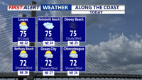
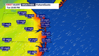
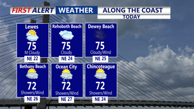
Afternoon temperatures are expected to reach the mid-70s across most of the region, though increasing clouds may keep highs closer to 70 degrees along the beaches. Breezy conditions continue, with sustained winds of 10 to 15 mph and gusts of 20 to 25 mph, especially near the shoreline. Can't rule out an isolated shower this afternoon along the beaches. HIGH risk of rip currents for Delaware Beaches, Ocean City and Assateague Island. Waves 3 to 7 feet.
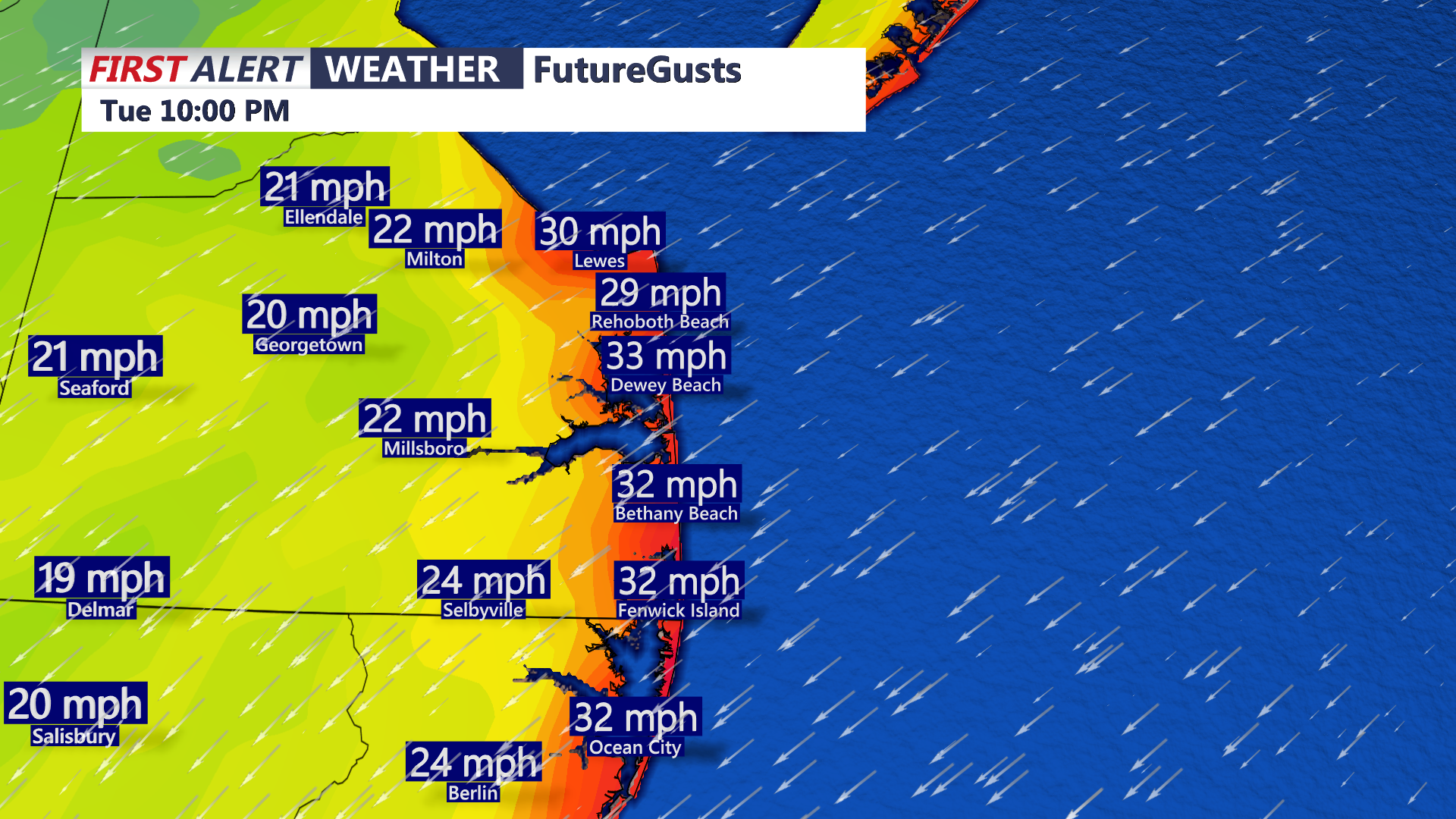
Gusty winds continue at the coast, northeast winds 15-25 sustained, gusts to 35 mph.
By tonight, high pressure shifts east into the Canadian Maritimes as the developing coastal low slides closer. That will increase the likelihood of showers pivoting in from the Atlantic, with concentrated rainfall chances near the coast. Overnight lows are expected to hold in the 60s under widespread cloud cover.

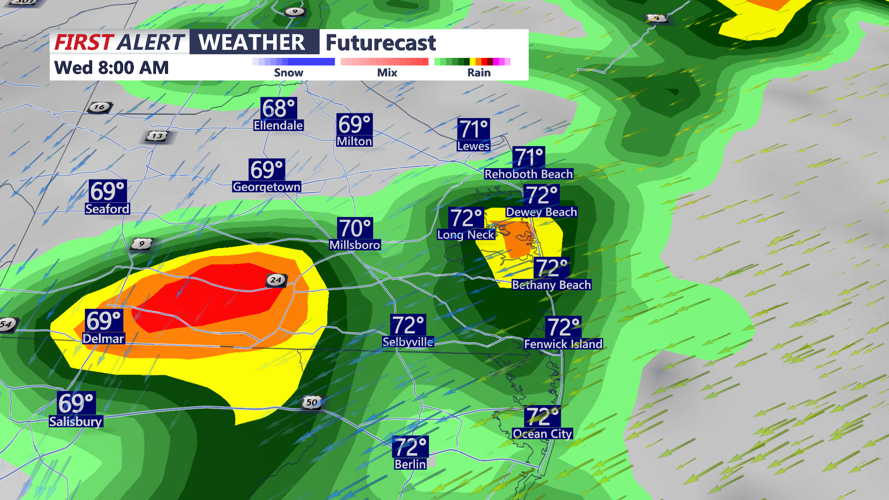
Scattered showers develop tonight, can't rule out some isolated downpours Wednesday morning, showers/drizzle pivot in off the Atlantic through Wednesday.
Wednesday will bring unsettled conditions as the offshore low continues to track northward. While the system is expected to remain well offshore, additional showers and sprinkles are possible, particularly along the coast in the morning. A brief downpour can't be ruled out. Winds may gust to around 30 mph before easing later in the day. Cooler air and cloud cover will keep highs in the upper 60s to low 70s. Rainfall totals will be on the light side, 0.25" to 0.50" possible.
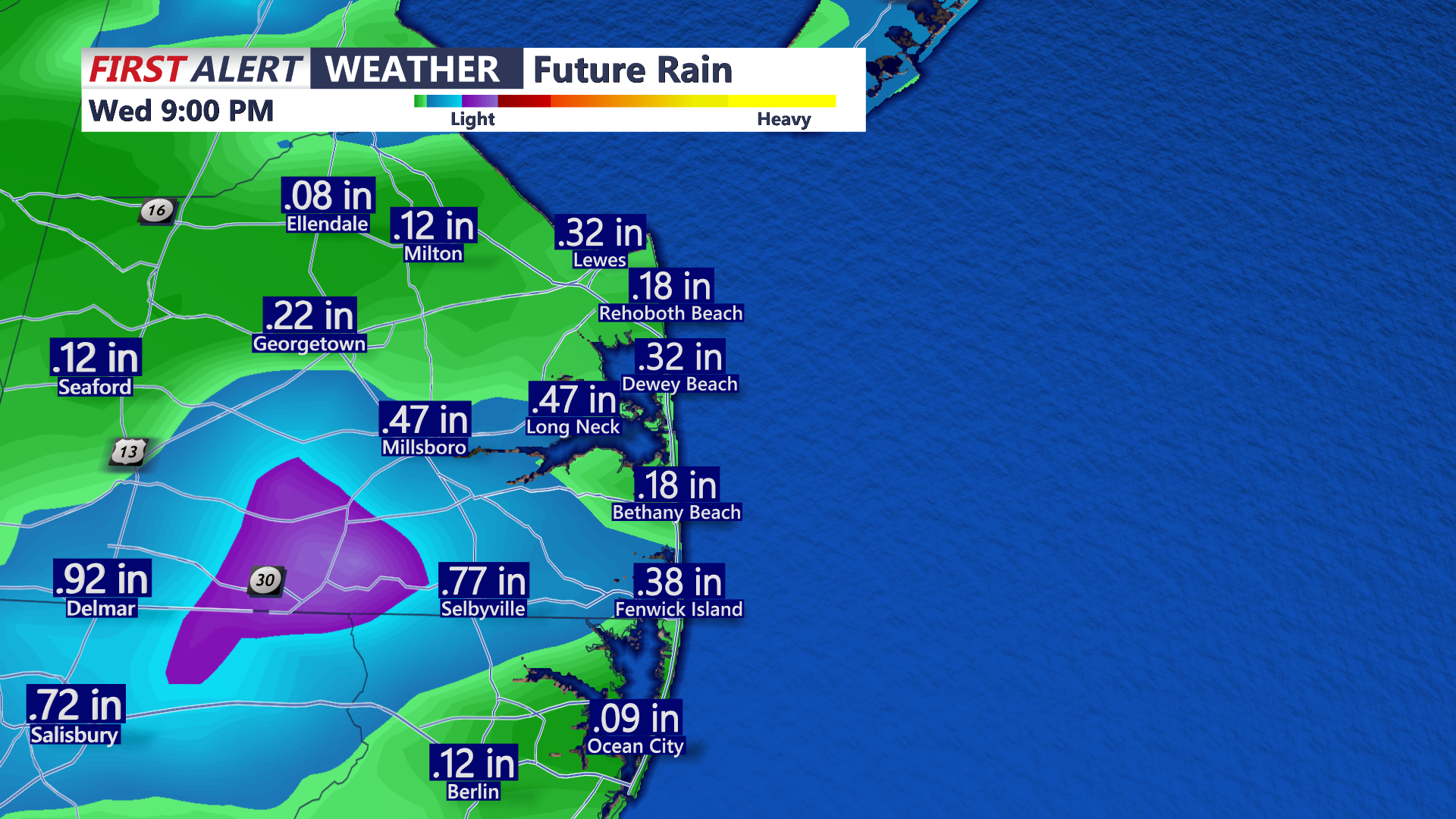
Rainfall from Tuesday night-Wednesday, generally light, 0.25"-0.50".
By Thursday, the low will move away and drier air will return, leading to more sunshine and milder conditions. Temperatures are forecast to rebound near 80 degrees with lighter northerly breezes.
Looking ahead to the weekend, expect temperatures near seasonal averages with mostly dry weather Friday and Saturday. A potential front may develop Sunday into Monday as another system organizes off the Southeast coast, but confidence in rainfall is low at this range.