


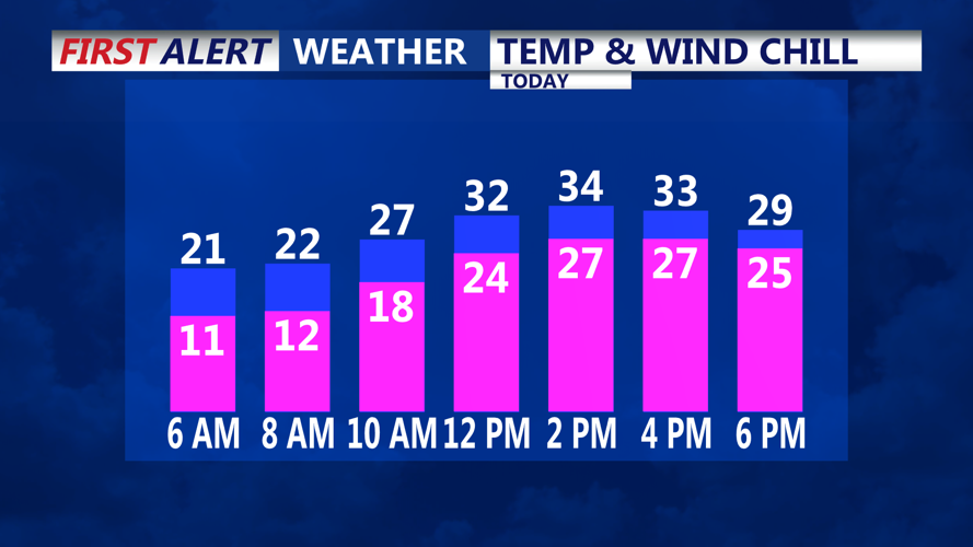


DELMARVA - Friday will bring calm but frigid weather to Delmarva as Arctic high pressure settles into the region. High temperatures are forecast to reach the lower to mid-30s under cloudy skies, accompanied by light winds, offering a brief respite from recent gusty conditions. Still see wind chills today in single digits to start to feeling the the teens and twenties through the afternoon.

Feeling like the twenties all day today
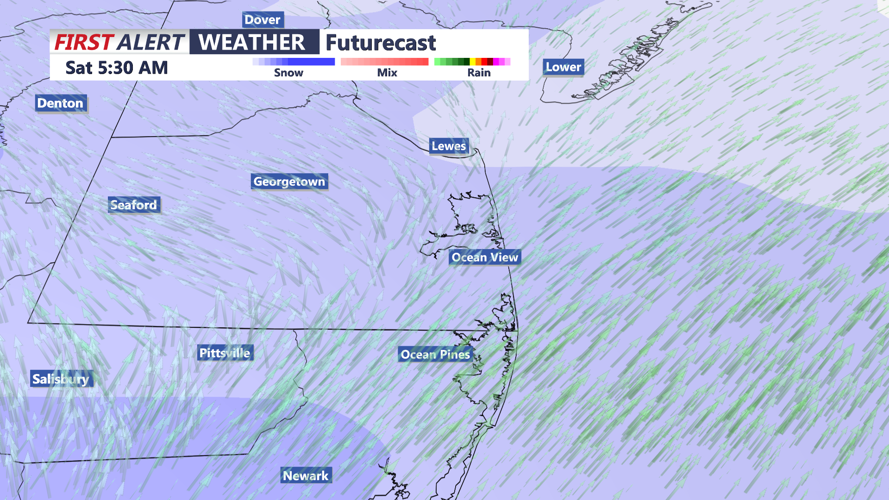
As the day transitions into night, a developing low-pressure system over the Gulf of Mexico will track northeast, arriving off the North Carolina coast by Saturday morning. Snowfall is expected to begin after midnight blanketing Delmarva with light to moderate snow.

Light to moderate snowfall through daybreak Saturday
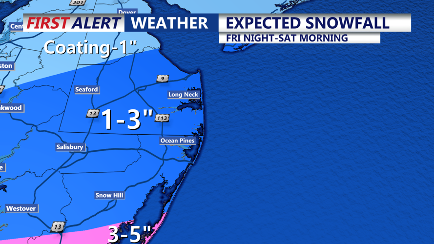
Most of the area will see accumulations ranging from a coating to 2 inches, with the possibility of up to 3 inches in parts of Sussex County and the Eastern Shore. Accomack County, under a Winter Storm Warning (7PM-1PM Sat), could see totals of 4 to 5 inches, marking the heaviest snowfall in the region.

Expected snowfall overnight Friday-Saturday midday
By Saturday morning, snowfall will taper off, but winds will intensify as the low-pressure system departs. Gusts of 20 to 30 mph are anticipated, creating wind chills that will make temperatures in the upper 20s to mid-30s feel 5 to 10 degrees colder.
High pressure returns Sunday, bringing lighter winds and partly to mostly sunny skies. Temperatures will edge slightly higher, reaching the 30s to around 40 degrees, though conditions will remain below average for this time of year.
Looking ahead to next week, Monday will offer the mildest temperatures, with highs climbing into the upper 30s to lower 40s. A reinforcing cold front will sweep through Tuesday into Wednesday, ushering in another wave of Arctic air. Highs are expected to stay below freezing midweek, with lows dipping into the teens and wind chills plunging into the single digits.
