


DELMARVA -- High pressure that has lingered over Delmarva will slide south later today as a cold front approaches from the west. The front is expected to pass through the region tonight, though it carries little moisture and should not produce precipitation.

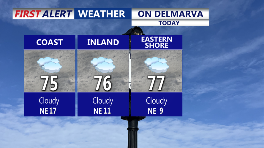
Cloudy skies on Delmarva, with highs in the mid to upper 70s, breezy conditions at the coast.
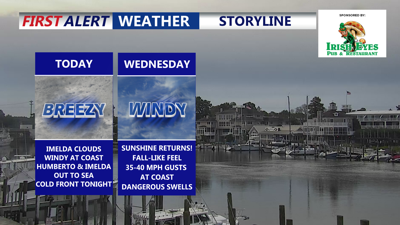
Skies remain mostly cloudy today due to high-level cirrus clouds from distant Hurricane Imelda, but dry conditions hold. Despite the clouds, afternoon temperatures will climb into the mid to upper 70s. Coastal areas will turn breezy with gusts reaching 20 to 30 mph.

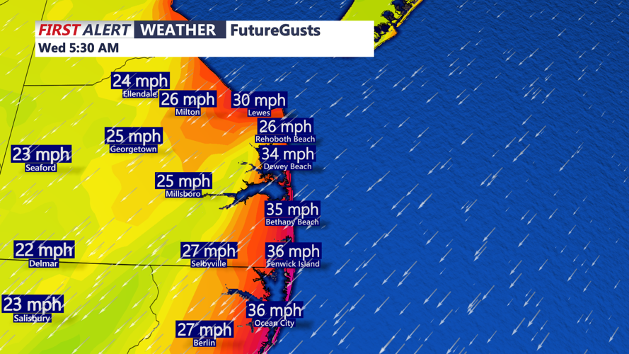
Gusts picking up out of the northeast at the coast 25-35 MPH, gust to 35 to 40 overnight into Wednesday.
By tonight, a cooler Canadian air mass begins to settle in. Overnight lows will dip into the mid to upper 50s inland and the lower 60s along the coast. On Wednesday, high pressure builds in from eastern Canada, tightening the pressure gradient between departing Imelda and Humberto in the Atlantic and the incoming cooler air. As a result, gusty northeast winds could reach near 40 mph along the shore, with lighter gusts inland. Skies will be mostly sunny, but highs will only reach the upper 60s to low 70s.

Cold front tonight will bring in cooler drier air, dew points drop into the 40s and 50s.
The cooler trend continues Wednesday night into Thursday as broad high pressure centers over New England. Clear skies overnight will allow lows to fall into the upper 40s to low 50s across Delmarva. Highs on Thursday remain below seasonal averages, topping out in the mid to upper 60s. A similar cool night is expected Thursday night, with the potential for radiational cooling inland.
By Friday, the high shifts offshore, and warmer air begins to return. Afternoon highs will rebound to near seasonal levels before climbing above average for the weekend. Highs will approach 80 degrees Saturday through Monday under mostly sunny skies, signaling a return to warmer early autumn weather.
