


DELMARVA -- Today is the last true cold day for Delmarva for a while as Arctic high pressure holds firm. Temperatures will only reach the mid to upper 30s this afternoon, and clouds will steadily increase ahead of a weak, fast-moving system.

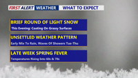
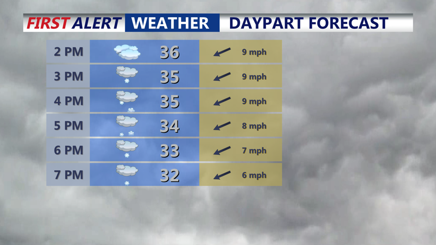
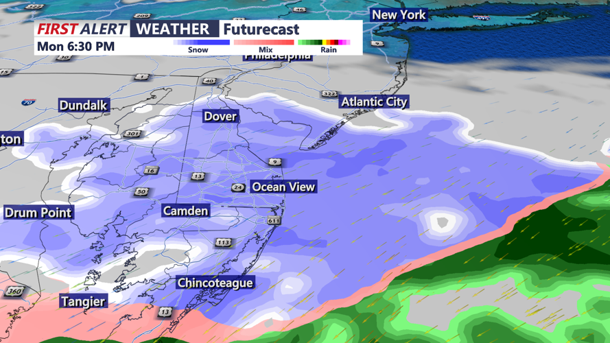
Light snow develops from west to east into the evening.
A period of light snow is expected late this afternoon through the evening.

Light snow will overspread the area late this afternoon into the evening, snow will change to a wintry mix and rain overnight into Tuesday morning.
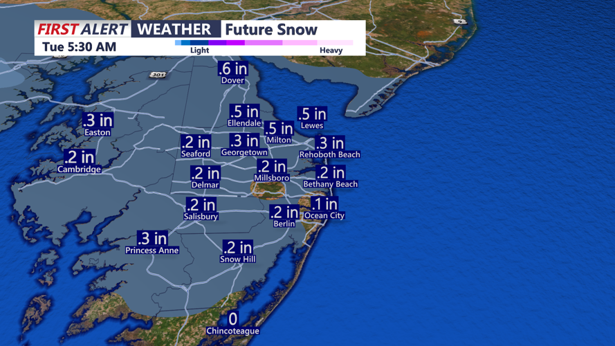
The good news: road impacts look minimal. Snow should melt on most roads and streets, with any accumulation mainly confined to grassy areas and elevated surfaces. Most locations end up with just a coating, though if the system “overperforms,” a localized 1 to 2 inches is possible.

Coating of snow expected primarily on grassy surfaces, if the system overperforms some could see an inch.
Overnight, the setup evolves as low pressure organizes over the Southern Plains and a warm front develops ahead of it. As the high slides offshore, winds turn south-southeast and help nudge warmer air north. That means the snow should transition to sleet or a wintry mix overnight, then change to light rain by Tuesday morning. At this time, no major issues are expected for the Tuesday morning commute.
Total Lunar Eclipse
A total lunar eclipse will take place around sunrise Tuesday morning, 6:33 AM. This is when Earth passes between the sun and the moon. The moon will have a reddish-orange color and this is a rare selenelion where the rising sun and eclipse will be out simultaneously. Only one big problem is I'm not expecting ideal viewing conditions on Delmarva due in part to showers and heavy cloudy cover moving through. The next total lunar eclipse after Tuesday morning will be December 28th, 2028.
Tuesday will feel very different: damp and cloudy, with showers in the morning and highs around 50. Another round of showers is possible Tuesday night into early Wednesday morning.
Rain chances remain on and off, but nothing looks significant. Wednesday through Friday, a wavering boundary stretching from the Ozarks to New England will help trigger several rounds of showers (roughly 30–60% coverage at times). A slightly stronger wave Thursday night could even produce a few rumbles of thunder. Overall, the periodic rainfall would be beneficial given ongoing drought conditions. Shower chances continue into the weekend, though coverage appears lower (around 20–40%) with the jet stream staying well north of the region.
From mid-week into the weekend, a pattern change brings a pronounced warm-up. Upper-level ridging builds over the eastern U.S. while troughing deepens in the West, and at the surface a Bermuda high takes control. By Wednesday, highs climb into the low 50s to low 60s. Thursday looks even milder with upper 60s to 70.

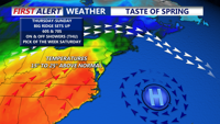
Bermuda high sets up late week and temperatures soar into the 70s into the weekend.
Friday’s temperatures are a bit trickier. Forecast guidance suggests a back-door cold front slipping in from New England, which could knock highs down compared to Thursday—generally low 50s to low 60s—but still above average. I did go with the warmer forecast with highs in the low 70s Friday. Over the weekend, that front should lift back north, putting the region back into the warm sector. Highs Saturday and Sunday should mostly reach the low to mid inland, while coastal communities may stay closer to the 50s thanks to chilly Atlantic waters.