


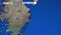


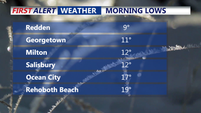
DELMARVA -- This morning was a frigid start to say the least. We saw some of the coldest temperatures in 2 years, Georgetown fell to 11 degrees, some locations in the single digits.

This Mornings Low Temperatures
This afternoon features, sunshine and frigid conditions as an arctic high-pressure system, currently centered over northern New York State, moves southward toward northern New Jersey before shifting offshore tonight. Temperatures will remain well below average, with highs only reaching the mid-30s despite sunny skies and light southerly winds.
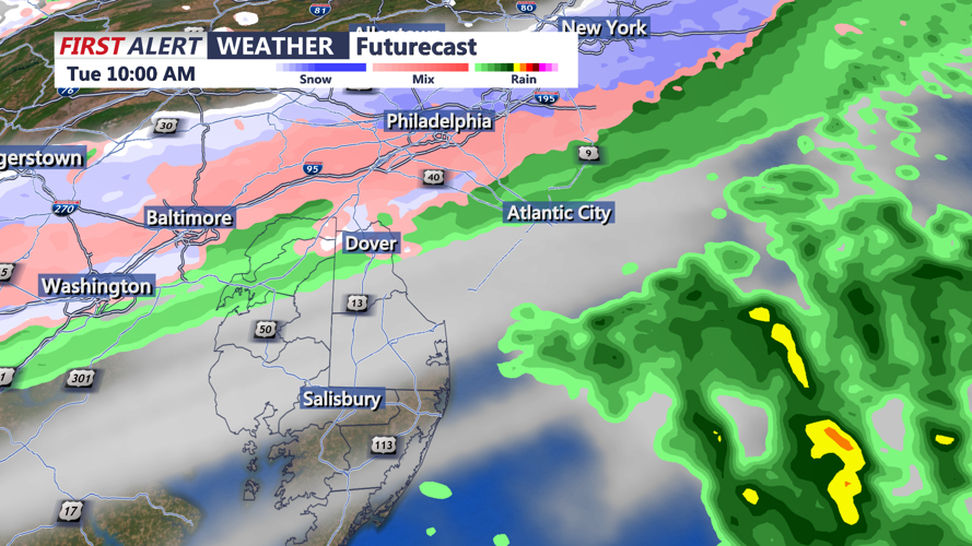
Overnight, a clipper system currently over the Midwest will track through the Great Lakes and southern Ontario, bringing a chance of light wintry precipitation to the Delmarva region by Christmas Eve morning. Surface temperatures will stay in the 20s overnight, potentially creating freezing rain conditions in parts of Maryland and Delaware. However, current forecasts do not indicate the need for a Winter Weather Advisory. Any precipitation is expected to taper off by midday Tuesday, with highs reaching the upper 30s to low 40s.

Light wintry mix possible, especially further north you go.
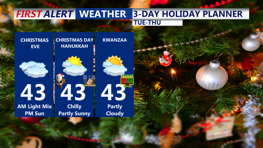
The weather will improve Christmas Eve night and on Christmas Day, with mostly clear skies and dry conditions dominating the forecast. A weak disturbance may bring some additional clouds Christmas night, and a stray flurry cannot be ruled out. Temperatures will remain below normal, with Christmas Day highs in the 30s to low 40s and lows dropping into the 20s or upper teens. Winds will stay light from the north to northeast.

Chilly Dry Conditions Through Thursday
Looking ahead, the weather pattern will shift as weak ridging builds over the eastern U.S. late in the week, leading to moderating temperatures that could climb above normal into the weekend. While some guidance suggests a chance of rain over the holiday weekend, significant weather events are not expected at this time.