


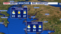


DELMARVA - For Friday, slightly cooler and much drier air will be across the area. High pressure will ridge in from the Great Lakes as an upper ridge develops further upstream. Under mostly sunny skies, temperatures will climb to near-normal readings with highs in the low to mid-80s. Dew points in the 50s will mean much more comfortable conditions than recently experienced. Winds will be from the north around 5 to 10 mph.
Short Term (Friday Night Through Sunday): Through the weekend, the theme remains surface high pressure with tranquil and mostly more comfortable conditions. Temperatures will be near normal, with highs mostly in the 80s to near 90, while lows will be in the 50s and 60s. The bigger difference making it feel more comfortable is that dew point temperatures are expected to range from the 50s to lower 60s through most of the weekend.
Long Term (Sunday Night Through Thursday): Relatively few changes are expected in the long-term period. The period will start tranquil, but by Tuesday, an active and increasingly humid pattern is anticipated.