


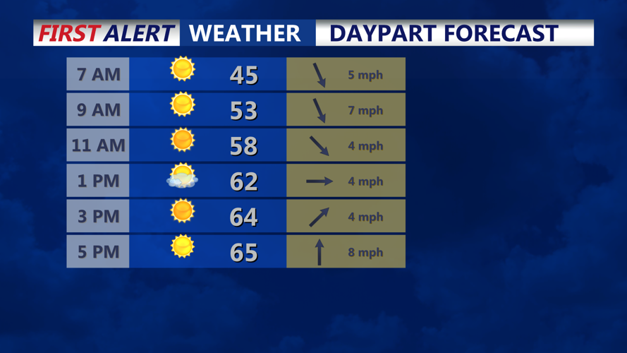


DELMARVA - A chilly start is expected across early Friday morning, especially in inland and sheltered areas where temperatures may dip close to freezing.
Light winds and mostly clear skies could allow patchy fog or light icing on sensitive vegetation in the coldest spots. Widespread frost is not expected, but residents with tender plants may want to monitor colder valley locations before daybreak.
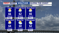
Dry weather is expected through much of Friday as temperatures climb into the 60s. Clouds will increase later in the day as weak low pressure approaches the region.
By Friday night into early Saturday morning, the system is expected to bring a quick round of light precipitation. Rainfall amounts should remain low, with only minor accumulation expected before a stronger coastal low develops farther south and east of the area Saturday.
The next system is expected to keep skies cloudier and temperatures cooler heading into Saturday, with the best rain chances focused near the coast. Forecast guidance for shows Friday starting dry before cooler, wetter conditions arrive Saturday.
