



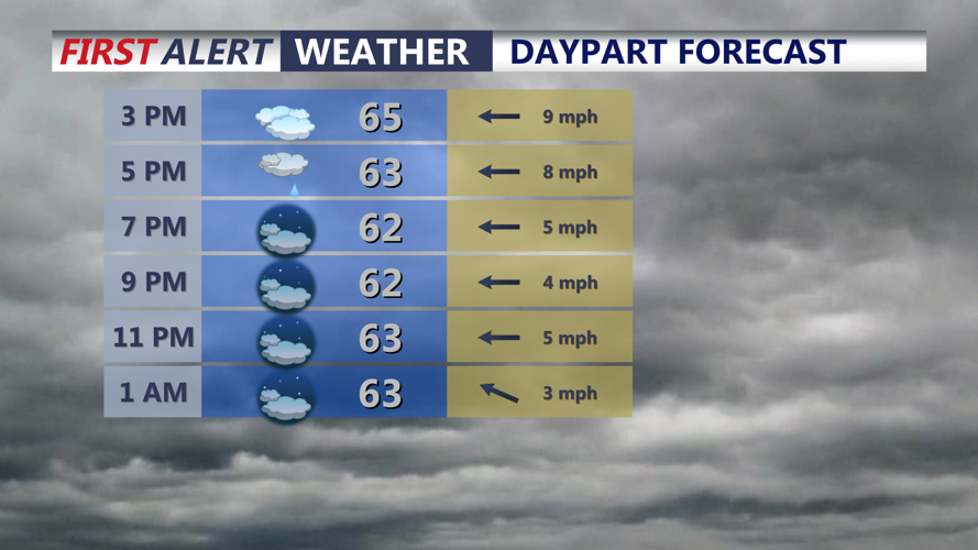

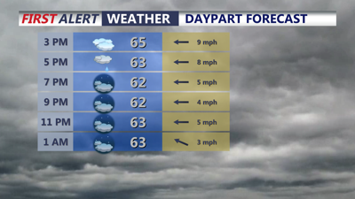
DELMARVA -- The temperature roller coaster is underway on Delmarva. Highs today are about 20 degrees cooler than where we were yesterday. We actually hit our highs for the day earlier this morning in the 70s. Spending most of the day in the mid to upper 60s thanks to cloudy skies and winds coming in off the Atlantic gusting to 25 mph. A cold front has stalled out to our south. A few spotty showers through the evening and overnight. Temperatures fall into the upper 50s to low 60s through Friday morning.

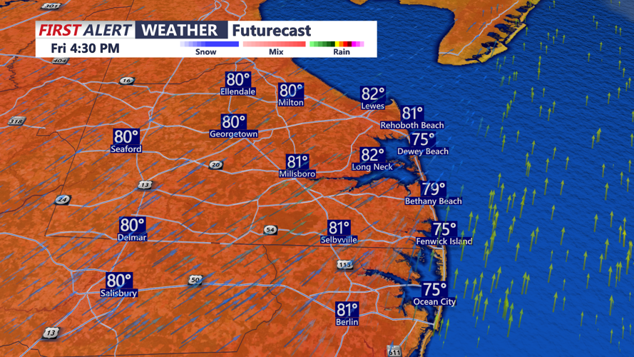
Temperatures surge back into the low 80s Friday ahead of a strong cold front.
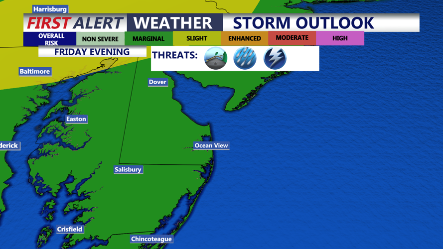
A warm front will lift through the region Friday morning, so the day starts off cloudy with some spotty showers, that will give way to a partly sunny much warmer, muggy afternoon with highs back in the low 80s. A vigorous cold front approaches the region Friday evening. Showers and a line of t-storms develops Friday afternoon just west of Delmarva. The Storm Prediction Center has a "Marginal" severe risk for most of our area, with a "Slight" risk along the I-95 corridor, New Castle County, NE Maryland. There is actually an isolated tornado threat for those areas. However for most of our area, Southern Delaware and the Lower Shore the primary threat would be damaging wind gusts in excess of 60 mph.

Isolated severe storms are possible Friday evening, damaging winds in excess of 60 mph is the primary threat.
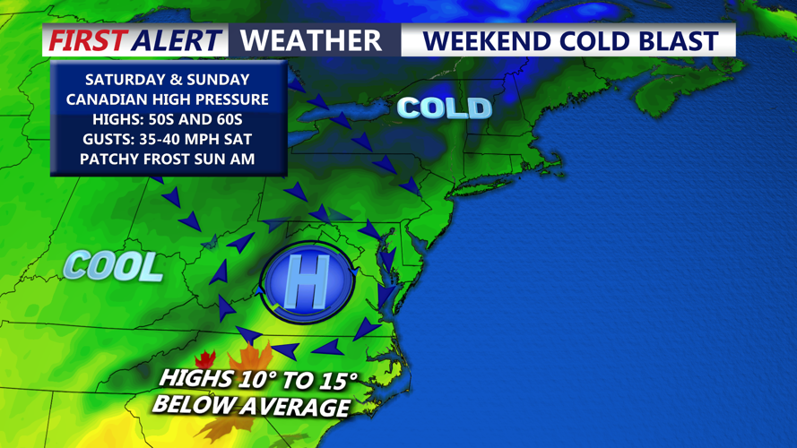
Showers and some steady rain late Friday night into early Saturday morning as the cold front pushes through. A few showers could be around with some clouds into daybreak Saturday, skies will clear through the afternoon and it will be blustery and much colder. Winds could gust 40-45 mph as temperatures will only be in the mid to upper 50s.

Some of the coldest air this fall season moves in Saturday into Saturday night.
By Saturday night winds should relax under clear skies and temperatures will fall into the mid/upper 30s away from the coast to lower 40s for most. Some frost is possible especially inland areas, Mid-Shore and to the north. Sunday will be a spectacular fall day as high pressure builds in, mostly sunny skies and highs in the upper 50s to low 60s.
Temperatures moderate back into the mid to upper 60s through next week as we will be mostly dry. However models are hinting at an area of low pressure developing off the southeast coast, uncertainty where that system will track and if it approaches our area. For now it looks like it will stay offshore to our east.
