





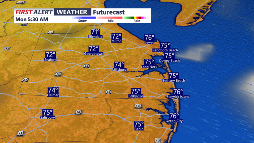



DELMARVA - A cold front will sweep across the Delaware beaches and into the Ocean City area late Sunday night, bringing a small chance of showers before much more comfortable weather arrives Monday.
Along the Route 1 corridor from Lewes and Rehoboth Beach through Dewey Beach, Bethany Beach and Fenwick Island, skies will remain partly cloudy Sunday evening as departing low pressure continues moving away from the Mid-Atlantic. A few showers could develop overnight as the cold front moves from north to south, although rainfall coverage is expected to decrease as the front reaches southern Delaware and coastal Maryland.
An isolated thunderstorm cannot be ruled out, but the threat for severe weather is expected to remain north of the area.
Conditions improve quickly behind the front early Monday as high pressure begins building toward the region. Skies will become mostly sunny across Sussex County and Ocean City, with noticeably lower humidity making for a comfortable September day.
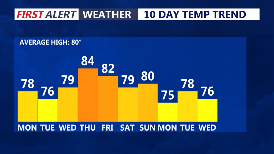
High temperatures Monday should generally reach the upper 70s to around 80 degrees inland, with slightly cooler readings along the immediate Atlantic coastline. Northwest to west-northwest winds around 10 mph could occasionally gust between 15 and 20 mph, especially near the beaches.
Monday evening will remain dry and pleasant as high pressure continues to strengthen. Mostly clear skies and comfortable humidity levels are expected from Rehoboth Beach south through Bethany Beach, Fenwick Island and Ocean City.
The quiet weather pattern should continue through Tuesday and Wednesday with partly to mostly sunny skies. Temperatures will gradually warm by midweek before another cold front approaches Thursday into Friday, potentially bringing the next opportunity for showers and thunderstorms.
