




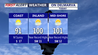
DELMARVA -- Dangerous heat and humidity will grip Delmarva today as a strong ridge of high pressure builds east into the region, pushing temperatures close to record levels across the peninsula.
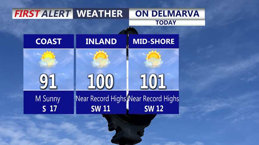
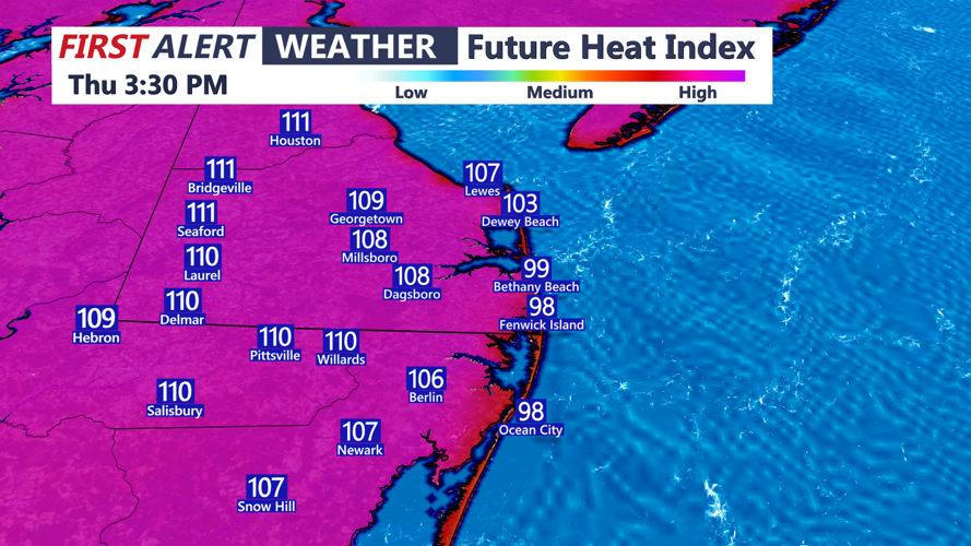
Highs will climb from 96 to 103 degrees inland and across the Mid-Shore, while coastal communities will range from the mid-80s to mid-90s. The heat index will make it feel like 106 to 114 degrees at times, creating a dangerous setup for anyone spending extended time outside. Georgetown’s record high for today is 99 degrees, set in 1953.

Heat indices this afternoon 106 to 114.
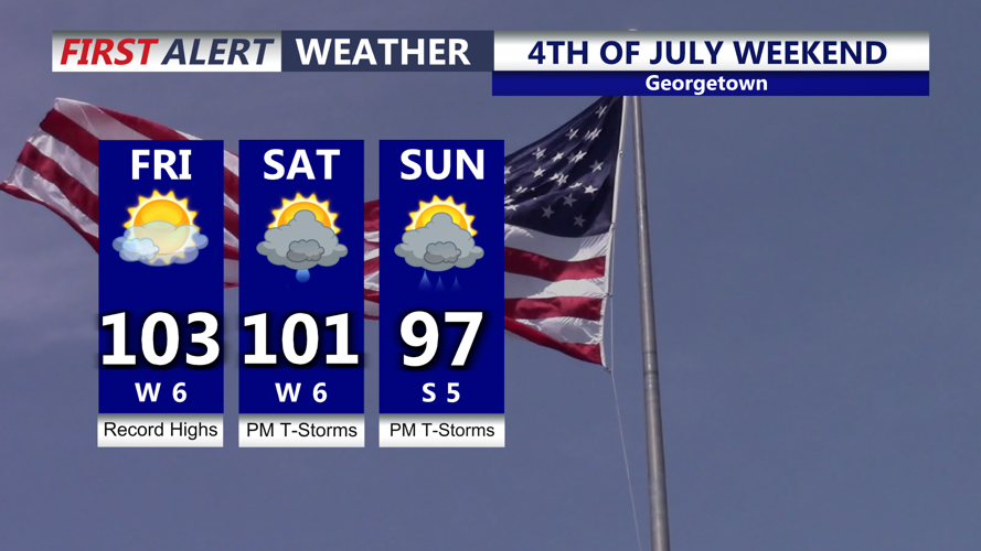
The heat will offer little relief tonight, with mostly clear skies and lows only falling into the upper 70s to low 80s. Extreme Heat Warnings continue through Saturday night, with the hottest conditions likely Friday, when highs could reach the low 100s and heat index values may again approach 114. Georgetown’s record high Friday is 101 degrees, set in 1954.

Record highs Friday, sweltering heat continues into the holiday weekend with an increase in storm chances.
The sweltering pattern continues into Independence Day, with highs near 101 degrees and heat index values from 100 to 108. Saturday’s record high in Georgetown is 100 degrees, set in 1966, and that mark could be challenged as holiday events get underway.
Thunderstorm chances will begin to increase Friday afternoon and evening, though the greatest storm coverage may stay north and west of Delmarva at first. A few storms could still become strong, with damaging winds the main concern.
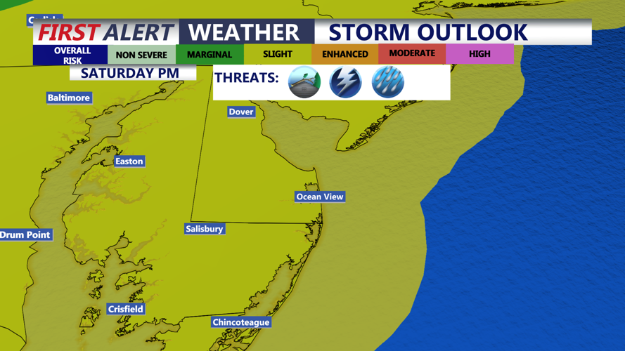
A more widespread storm threat is possible late Saturday afternoon into Saturday night as the ridge begins to break down and a trough slides into the Northeast. Delmarva is under a slight risk for severe thunderstorms Saturday, with damaging winds again the primary threat. Storm chances may remain active into Sunday and Monday as the pattern turns slightly cooler and more unsettled.

Slight chance of severe storms Saturday late afternoon-evening, greatest threat damaging winds/downburst.
Anyone with outdoor holiday plans should prepare for extreme heat, stay hydrated, take frequent breaks in air conditioning or shade, and have a way to receive weather alerts if thunderstorms develop by downloading the COASTTV Weather App.
