


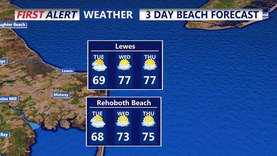
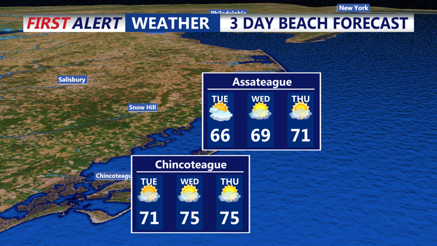


DELMARVA - An onshore southeasterly flow will continue over Delmarva as a warm front moves in from the west. This setup will bring increased cloud cover throughout the day, with mid-level clouds across the region and some lower stratus clouds near the coast. A few isolated sprinkles or light showers are possible along the coast, though most of the area will stay dry. Highs will range from the low to mid-60s in northern Delmarva to the upper 60s and low 70s in the south.
Tuesday Night:
Clouds will persist Tuesday night as a mid-level ridge starts to build over the area. There’s a low chance of light showers or sprinkles north of the region, particularly around the I-80 corridor. Lows will range from the mid-40s to low 50s, with temperatures staying mild for late October.
Wednesday:
The mid-level ridge will strengthen and peak over the area, bringing warmer conditions. Expect partly cloudy skies and dry weather across Delmarva. High temperatures will be noticeably warmer, reaching the upper 60s to upper 70s, about 5-10 degrees above normal for this time of year.
Thursday:
The ridge will slowly move eastward, allowing temperatures to climb further. Skies will remain partly cloudy, and highs will range from the mid-70s to near 80 degrees, which is about 15 degrees above average for late October. Overnight lows will stay mild, mainly in the 50s across the area.