


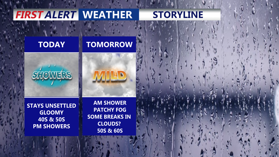


DELMARVA -- The peninsula stays stuck under a gray, gloomy pattern today. Expect a cool, damp feel with afternoon highs mainly in the upper 40s to low 50s inland, with a chillier feel closer to the coast. A warm front lifts north through the region today, setting the stage for increasing moisture as the day goes on.

Gloomy Tuesday, another round of showers moves in this evening.
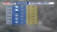
This evening and overnight, scattered showers and areas of drizzle will develop as weak low pressure moves through. With moisture pooling near the ground, patchy fog is likely to form overnight, and temperatures will settle into the mid to upper 40s. If you’ll be traveling late, plan for damp roads and occasional reductions in visibility.

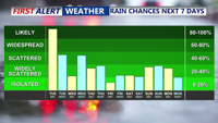
Impulses of low pressure will ride along a stalled front to the north of Delmarva.
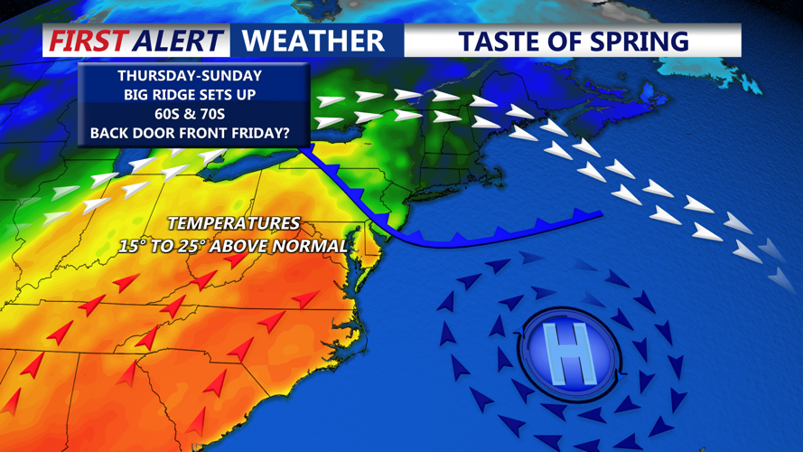
A noticeable warm-up arrives midweek. By Wednesday, temperatures rebound into the 50s to near 60 for much of the region, kicking off a stretch that will run well above average. The larger pattern shifts later this week and into early next week as a trough develops over the western U.S. while ridging strengthens over the eastern U.S. At the surface, a large Bermuda high becomes increasingly influential. As a result, temperatures late this week into early next week are forecast to run about 10 to 20 degrees above normal.

Ridge of warmth late week into the weekend, temperatures soar into the 70s.
The temperature forecast becomes more complicated from Thursday through Saturday because a front is expected to waver back and forth across the area. It may lift north on Thursday, then stall and slide back south as a backdoor front Friday into Saturday. Small changes in where that boundary sets up could lead to big differences in temperatures from one part of Delmarva to another. South of the boundary, readings will warm into the upper 60s to mid/upper 70s, while areas near the front hover closer to 60. North of the boundary, temperatures may stay much cooler in the 40s and 50s. It’s also possible that Friday and Saturday end up cooler than currently forecast in more places if a persistent east to northeast wind locks in.
