




Quiet weather will continue early Thursday morning through early Friday morning as a weak cold front moves through the region without producing rain.
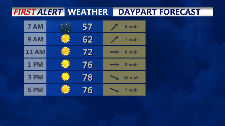
Thursday morning will start dry with temperatures generally in the 50s. Winds will initially be from the southwest before shifting to the west and northwest as the front passes later in the morning and afternoon.
Afternoon temperatures are expected to climb into the mid-70s, making Thursday one of the milder days of the week. Skies should remain generally fair, with no significant weather hazards anticipated.
Winds may become somewhat gusty during the afternoon, with occasional gusts around 20 to 25 mph possible before easing Thursday evening.
Cooler and drier air will settle into Thursday night. Temperatures are expected to fall into the upper 40s to low 50s by early Friday morning under tranquil conditions.
Along the coast, seas will generally run 2 to 4 feet. Westerly winds behind the front may remain breezy for a time before gradually diminishing Thursday evening.
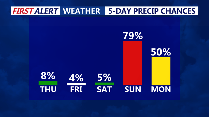
The quiet pattern is expected to continue through Saturday. Forecasters will then turn their attention to the remnants of Tropical Storm Isaias, which could bring widespread rain to the region Sunday into early Monday.
Heavy rainfall will be possible with that system, although exact totals and timing remain uncertain.
