


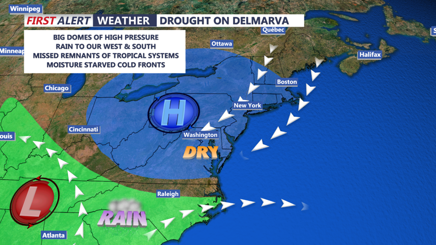
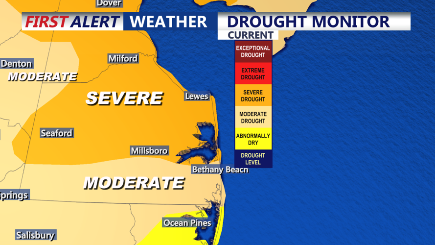


DELMARVA -- As we head into the weekend, today will feature abundant sunshine with comfortable highs in the low to mid-60s. Winds will be lighter than on Thursday, providing a pleasant start to the weekend. However, the severe drought affecting the region continues, with Georgetown now reaching 28 days without measurable rainfall. This dry spell is approaching record territory, as the longest streak of dry days for the area stands at 34, set between October 17th and November 19th, 2001. Unfortunately, no significant rain is in the forecast, and the drought is expected to persist into next week.

A weak frontal system will move through the area tonight, followed by a secondary, stronger cold front on Saturday. Despite these fronts, there will be little moisture to work with, and any potential showers are expected to be spotty and light, likely not even measurable. As a result, the chance of precipitation remains below 15%. Friday night will be milder, with lows in the 40s to low 50s.
On Saturday, breezy conditions return with northwesterly winds gusting up to 25 mph, raising concerns for fire weather due to low relative humidity and dry conditions. Skies will become mostly sunny, with highs ranging from the 60s at the coast to low 70s inland. Fire weather warnings may be necessary, so residents should remain cautious of any outdoor burning or activities that could spark a fire.
Winds will diminish by Saturday evening as high pressure begins to build in, leading to a mostly clear and chilly night. Temperatures will drop into the mid to upper 30s in inland areas, with coastal locations staying a bit warmer in the low 40s.
By Sunday, high pressure will dominate, bringing sunny skies and lighter winds. Highs will be slightly cooler, generally in the upper 50s to low 60s, making for a crisp but pleasant fall day.

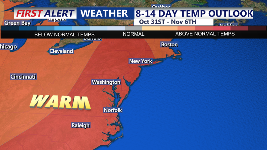
Looking ahead to next week, high pressure will remain firmly in control over Delmarva, ensuring continued dry and mostly sunny weather. Temperatures will start off near or slightly below average but will gradually warm as southerly winds return midweek. By Wednesday and Halloween, highs are expected to climb into the 70s to near 80, offering a brief warm-up before the next potential weather system approaches.