


DELMARVA -- High pressure builds in from the northwest. Temperatures will remain cool but comfortable, reaching the low to mid 70s across much of the peninsula, with upper 50s to mid 60s along the coast. Skies will be mostly sunny with occasional mid-level clouds. Winds from the north will range from 10 to 20 mph, with gusts reaching up to 30 mph.

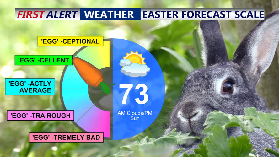
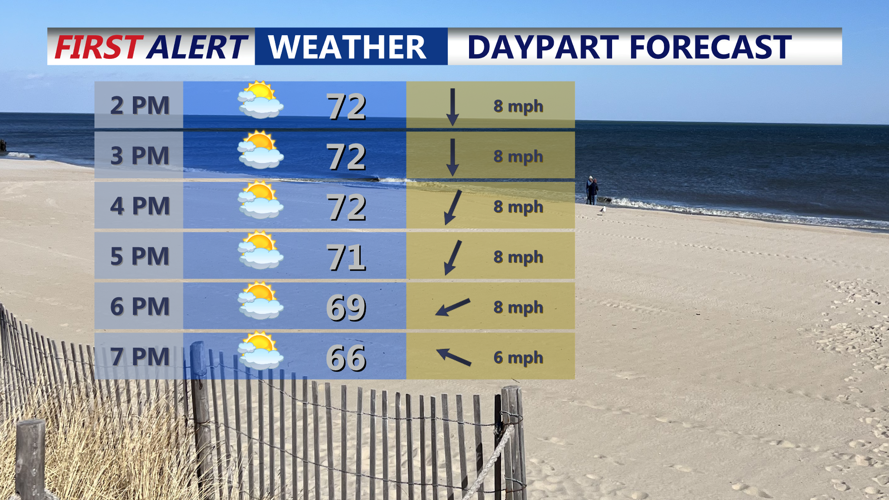
Mix of sun and clouds through the afternoon with highs in the low to mid 70s.
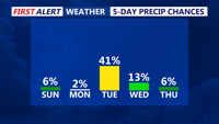
Quiet conditions are expected Sunday night as high pressure lingers to the north. However, weak easterly flow could introduce some low clouds, mist or drizzle overnight. Temperatures will drop into the 50s across the region.

Rain chances hold off until Tuesday morning as a cold front pushes through late Monday night.
On Monday, southeasterly flow prevails as the high shifts east and a cold front approaches from the west. This setup will keep the region cool and may allow morning clouds to linger. The warmest temperatures are expected along the Eastern Shore of Maryland, where highs will climb into the low 70s. Elsewhere, highs will remain in the 60s, with the coast staying in the 50s.
A cold front will move in Monday night, but with lingering marine influence and weakening instability, rain chances will be limited. Showers and storms are expected to stay mainly north of the region. Overnight lows will range from near 60 in central areas to the 50s elsewhere.
Tuesday will bring a noticeable warm-up as the cold front helps clear out the marine layer. Afternoon highs will rise into the 70s and may approach 80 degrees in some inland spots.
High pressure will return Tuesday night, bringing partial clearing and overnight lows in the 50s. The fair weather pattern will hold through Wednesday, with mostly sunny skies and highs in the low 70s. Quiet and cool conditions are expected again Wednesday night, with lows in the upper 40s to low 50s.
By Thursday, the high shifts just east of the region, promoting another warm day. Highs will reach the mid to upper 70s inland, with coastal zones staying in the 60s under partial sunshine.
A new system approaches Thursday night, bringing a slight chance of showers. Rain chances will increase slightly on Friday as southwesterly flow develops. Highs will remain in the mid-70s inland but may be tempered by clouds and showers. Coastal highs will remain in the 60s.
A stalled front near the region Friday night into Saturday may bring additional showers. Although widespread rain is not expected at this time, temperatures will stay mild with lows in the 50s and highs near 70.
