


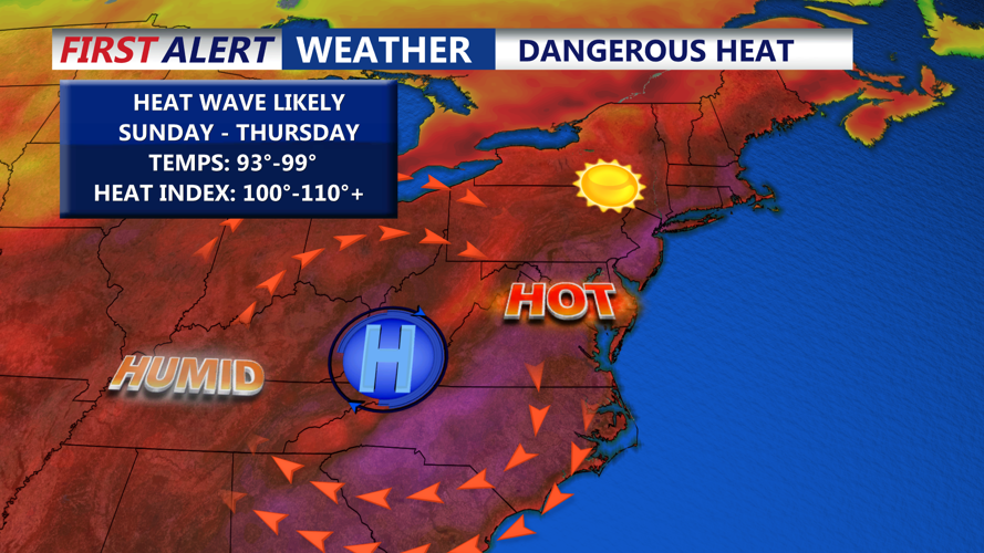
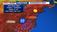


DELMARVA -- The first official weekend of summer is off to a scorching start across Delmarva, this is only a taste of what's to come as an intensifying heat wave will grip the region through midweek.
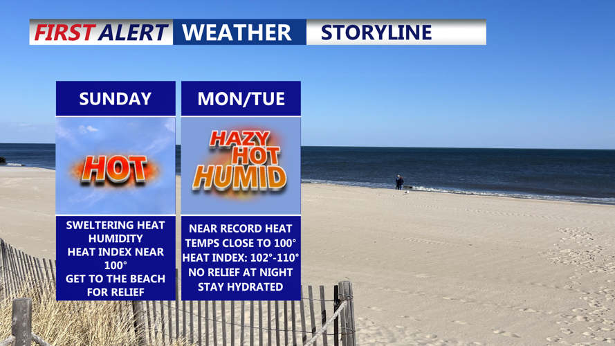
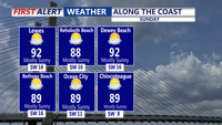
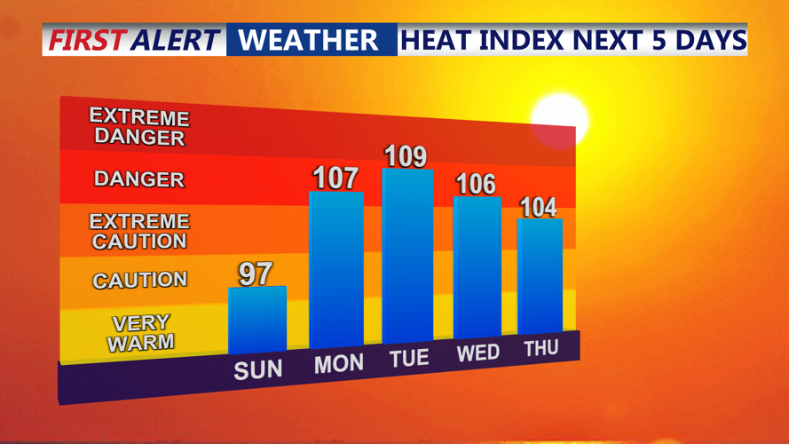
Sunday begins warm and mostly sunny, with inland highs in the mid-90s and coastal areas reaching the upper 80s to low 90s. While still manageable for many, the rising humidity will push heat index values close to 100 degrees in interior sections — just a sample of the dangerously hot and humid conditions expected in the days to come.

Highs along the coast in the upper 80s to low 90s.
Sunday night will be quite warm and muggy staying in the mid to upper 70s under mostly clear skies.

A dome of high pressure will lock in the heat and humidity through Thursday.
By Monday and Tuesday, the heat will reach its peak as a powerful ridge of hot, dry high pressure spreads across the eastern U.S.
A Heat Advisory is in effect from 8 a.m. Monday through 8 p.m. Tuesday for Sussex and Kent counties in Delaware and Caroline and Talbot counties in Maryland. Expect heat index values to climb between 105 and 110 degrees, on Monday and Tuesday, under hazy skies.

Heat indices between 105 to 110 Monday through Thursday.
Overnight conditions won’t offer much relief either, with lows only dipping into the mid to upper 70s, and in some urban areas, possibly remaining near 80 degrees. This lack of cooling heightens the risk of heat-related illnesses, especially for those without access to air conditioning.
By midweek, the dominant ridge begins to flatten and weaken, allowing slightly cooler air and increased cloud cover to move in. Still, Wednesday is expected to remain hot, with highs in the mid to upper 90s and heat index values near 100-105 degrees.
Further improvement is possible by Thursday and Friday as the ridge continues to erode. A surface trough may bring more clouds, a better chance of storms, and slightly lower temperatures — still in the lower 90s on Thursday, but cooling into the 80s by Friday.
Safety Tips:
Drink plenty of water
Take frequent breaks in the shade or indoors
Limit strenuous activity during peak heat hours
Never leave children or pets in vehicles
Check on elderly neighbors or those without AC
