




DELMARVA - Breezy conditions will continue across Sussex County late Sunday evening before stronger winds develop Monday as a cold front moves through the region. Meanwhile, a potentially significant coastal storm or nor'easter could bring heavy rain, gusty winds and coastal flooding concerns to southern Delaware later this week.
Late Sunday evening will feature partly cloudy skies and gradually diminishing winds. Overnight temperatures will fall into the upper 30s to middle 40s, with the coldest readings expected across inland communities, including Georgetown, Seaford, Laurel and Bridgeville.
West winds will generally average around 10 mph overnight before strengthening Monday morning.
As a cold front crosses Sussex County, west to northwest winds will increase to 15 to 20 mph, with occasional gusts reaching 30 to 35 mph during the late morning and afternoon.
The strongest gusts will be particularly noticeable across open areas and coastal communities, including Lewes, Rehoboth Beach, Dewey Beach, Bethany Beach and Fenwick Island.
Although widespread land-based wind advisories are not anticipated, gusty conditions could blow around unsecured outdoor objects and make travel more challenging for high-profile vehicles.
The stronger winds could also strip remaining autumn leaves from trees across Sussex County, particularly in areas where fall foliage has already reached or passed its peak.
Despite the gusty conditions, Monday should remain largely dry, with a mixture of sunshine and passing clouds. Temperatures will remain seasonably cool, although the persistent wind will make conditions feel colder.
Winds should gradually diminish Monday evening as the cold front moves offshore and high pressure begins approaching from the southwest.
Marine conditions will be considerably more hazardous along the Sussex County coastline.
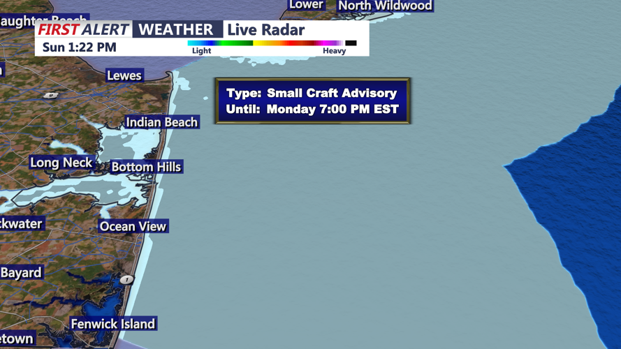
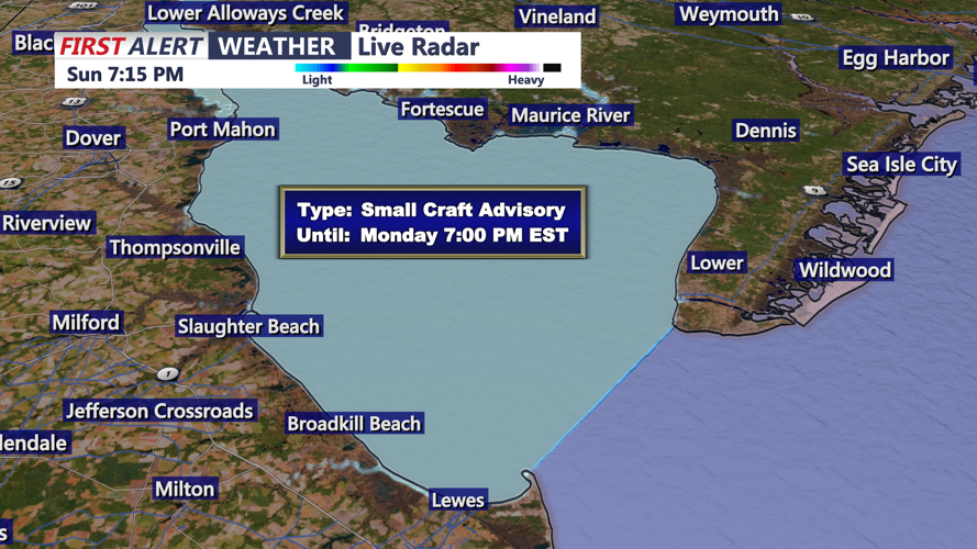
Small Craft Advisories are in effect for the Atlantic coastal waters and Delaware Bay through 7 p.m. Monday.
West to northwest winds over the coastal waters could reach 25 to 30 mph, with gusts approaching 35 mph. Offshore seas are expected to build to 4 to 6 feet, creating hazardous conditions for smaller vessels.
Boaters operating near Cape Henlopen, Indian River Inlet and the Atlantic waters off Bethany Beach and Fenwick Island should exercise caution.
Conditions over the water should gradually improve Monday evening as winds and seas diminish.
Attention will then shift toward a developing coastal storm that could affect Sussex County Thursday through Friday night.
A strong upper-level weather system moving into the eastern United States could support the development of low pressure near the Mid-Atlantic coastline. Depending on its eventual track and strength, the system could become a nor'easter.
The primary concern for Sussex County will be the potential for widespread rainfall, gusty winds and elevated tidal water levels.
Communities including Georgetown, Seaford, Millsboro and Laurel could experience periods of steady rain, while coastal locations such as Lewes, Rehoboth Beach, Dewey Beach, Bethany Beach and Fenwick Island may face additional impacts from strong winds and rough surf.
Coastal flooding could become a concern along Delaware Bay, the Atlantic beaches and vulnerable back-bay communities, particularly if the storm produces a prolonged period of onshore winds.
However, considerable uncertainty remains regarding the storm's precise track, intensity and timing.
A storm tracking directly over Sussex County could shorten the duration of strong onshore winds, potentially reducing coastal flooding impacts. A track farther offshore could produce a longer period of onshore flow and increase the risk of elevated water levels.
Rain remains the primary precipitation concern for Sussex County, with no significant snow threat currently indicated for southern Delaware.
Tuesday and Wednesday are expected to remain generally dry, offering a break between Monday's gusty weather and the potentially unsettled conditions later in the week.
Much colder air is expected to arrive behind the late-week storm, bringing a noticeable drop in temperatures Friday and especially over the weekend.
For Sussex County residents, Monday's gusty winds will be the immediate concern, followed by the possibility of a more significant coastal weather event Thursday through Friday night.
Residents along the Delaware beaches and low-lying coastal communities should monitor forecast updates as confidence improves regarding the storm's eventual track and potential impacts.
