




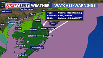
DELMARVA -- Strong high pressure to the north and a coastal low are combining to bring strong gusty winds, dangerous life threatening surf and coastal flooding to the peninsula. Showers winding down through the afternoon, overcast windy day on tap with highs in the mid to upper 60s. Dangerous life threatening surf will continue with wave heights of 6 to 12 feet causing beach erosion. High Surf Advisory remains in effect through Saturday night.

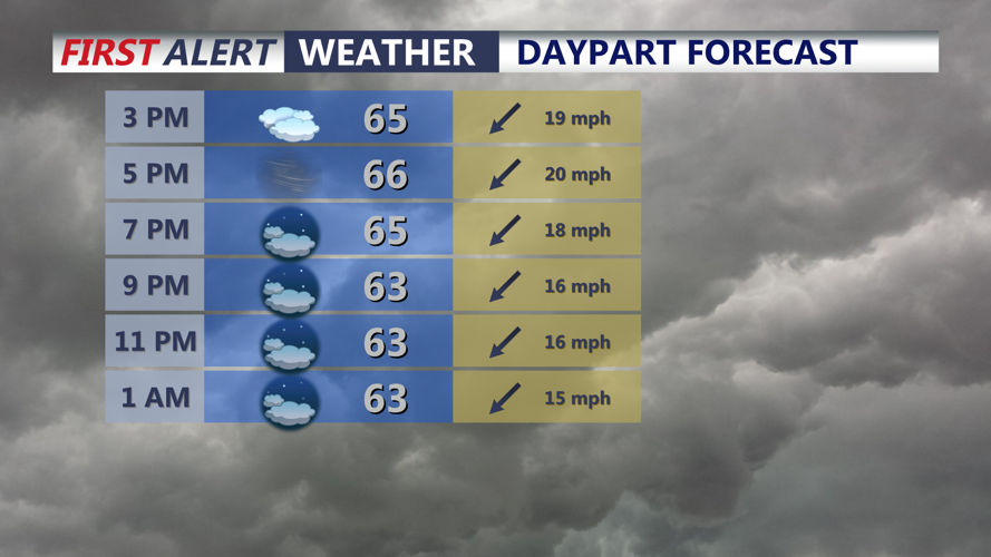
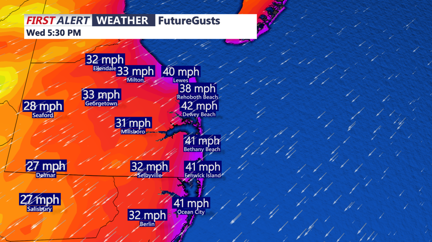
Overcast skies, highs in the mid to upper 60s, winds out of the northeast gusting 40-50 mph.
Winds will gust out of the northeast 40 to 50 mph at the beaches, 25 to 35 mph inland to the Mid-Shore. Wind Advisory is in effect at the coast until Thursday 8PM.Tonight expect cloudy windy conditions with lows in the upper 50s to low 60s.

Wind gusts at the beaches 40 to 50 mph into the afternoon and evening.
Thursday will feature continued windy conditions under cloudy skies, some drizzle possible along the immediate coast. Highs in the upper 60s. Winds will gust to 45 mph at the beaches.
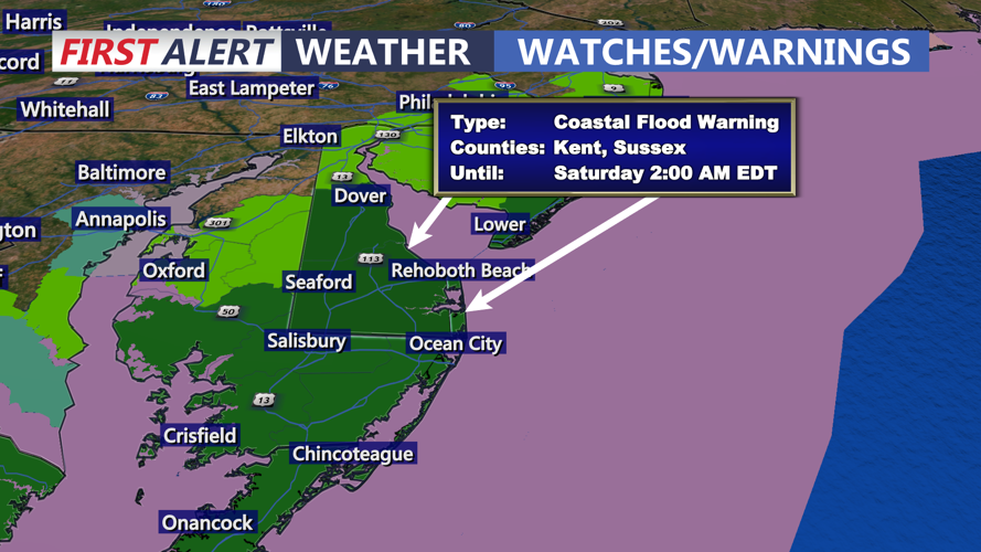
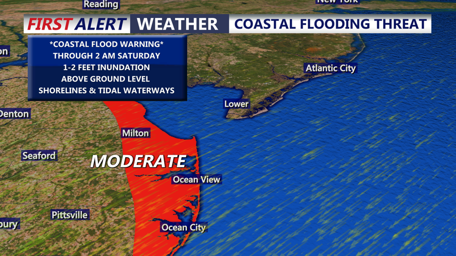
Coastal Flood Warnings are now up through 2 AM Saturday, MODERATE to MAJOR tidal flooding is expected through high tide cycles. One to two feet of inundation is possible above.

MODERATE tidal flooding is possible through the next few high tide cycles. Up to 1 to 2 feet of inundation is possible.
Low pressure will strengthen offshore and push to the northeast Friday into the weekend bringing breezy conditions, isolated showers and continued threat of coastal flooding.
As we head into the weekend the coastal low will continue to deepen offshore, some showers are possible into Saturday and Sunday, we have trended a bit drier in recent model runs with low pressure tracking more into New England. Looking at partly to mostly cloudy skies with highs in the upper 60s to low 70s. It will continue to stay on the breezy side through the weekend as the coastal low weakens into early next week. Will have to continue to watch the coastal flooding threat over the weekend with a full moon on Saturday.
Next week high pressure builds into the region as temperatures warm into the mid to upper 70s next week with mostly sunny skies returning.
