


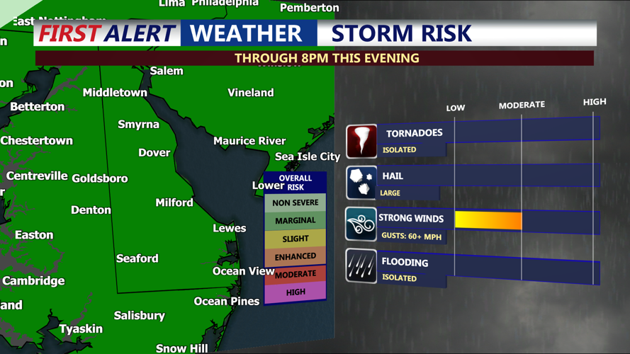

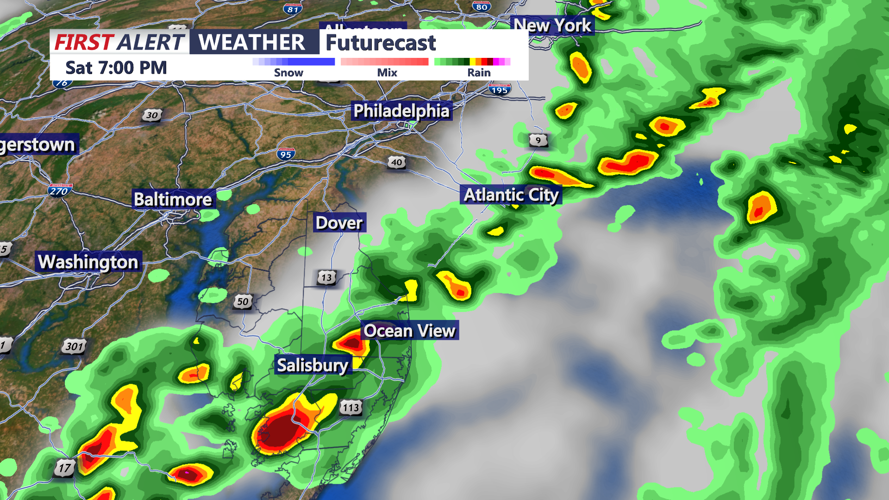


DELMARVA -- A cold front is set to cross Delmarva this afternoon into this evening as low pressure tracks to the north. Scattered showers and downpours will continue across the region, with the threat for isolated severe storms through at least 8 p.m. Saturday. The Storm Prediction Center has placed the entire Delmarva Peninsula under a marginal risk (1 out of 5) for severe weather, with damaging winds being the primary concern.

Storm Prediction Center has a "marginal" (1 of 5) risk of an isolated severe storm through 8PM Saturday Evening, primary threat gusty wind.

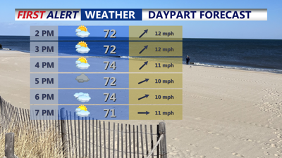
Scattered showers and storms through 8PM Saturday evening.
Behind the front, skies will clear quickly, and winds will become gusty out of the northwest, reaching speeds up to 30 mph. Temperatures will fall into the mid to upper 40s under clear skies, setting the stage for a cooler, breezy Sunday.
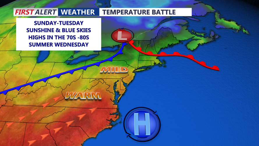
Sunday welcomes the return of bright blue skies across Delmarva, although cooler air will settle into the region. Highs will range from 64 to 70 degrees, with northwesterly winds continuing to gust up to 35 mph. While the sun dominates the forecast, breezy conditions will make it feel cooler throughout the day.
High pressure moves across Delmarva on Monday, allowing for calmer winds and a beautiful, warmer afternoon. Wall-to-wall sunshine is expected, with highs rebounding into the low 70s. Winds will ease compared to Sunday, and with light flow developing, a sea or bay breeze may form during the afternoon hours. Overnight lows will dip into the mid to upper 40s to near 50 degrees.

Sunshine returns Sunday, stay cool, warm up begins Tuesday-Wednesday.
Mild and even warmer conditions are forecast for Tuesday as a warm front lifts through the area. High temperatures could reach near 80 degrees. A south to southwest breeze will develop as the pressure gradient tightens ahead of the next cold front.
By Wednesday, a cold front is expected to pass through, likely during the morning to midday hours. Showers may be limited with this front as it appears to move quickly, but a few rain showers cannot be ruled out. Temperatures will cool slightly during the day, accompanied by a shift in winds from the west to northwest and a return of drier air.
Surface high pressure will slide by to the north Thursday, keeping conditions mostly dry to start the day. However, moisture will return later as another warm front approaches, potentially bringing scattered showers by late Thursday and Thursday night.
Friday looks to feature another cold front, which will bring a better chance for more widespread showers and possibly isolated thunderstorms. Temperatures will be seasonable, with highs ranging from the 60s to low 70s on Thursday, and then depending on the northward reach of the warm sector, Friday’s highs may vary across the region.
