



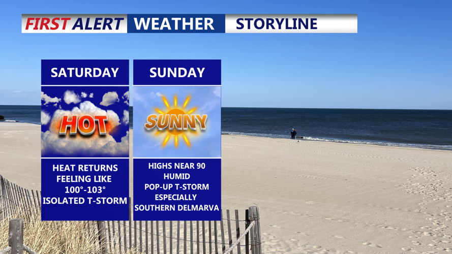

DELMARVA -- Saturday brings a quick return to summer’s heat across Delmarva following Friday’s brief reprieve.

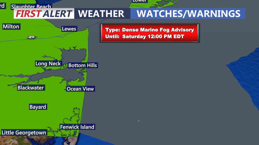
Dense Marine Fog Advisories are up through 12PM Saturday.
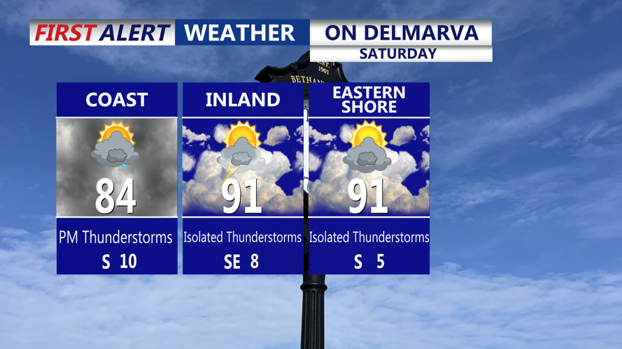
A warm front pushing north Saturday morning will gradually clear lingering clouds, allowing sun to break through and temperatures to climb rapidly. After some morning fog especially along the coast expect partly cloudy skies. Highs are forecast to reach around 90 degrees across much of the region, with dew points rising into the 70s.

AM Fog along the coast, warming into the upper 80s to low 90s, with isolated t-storms in the afternoon.
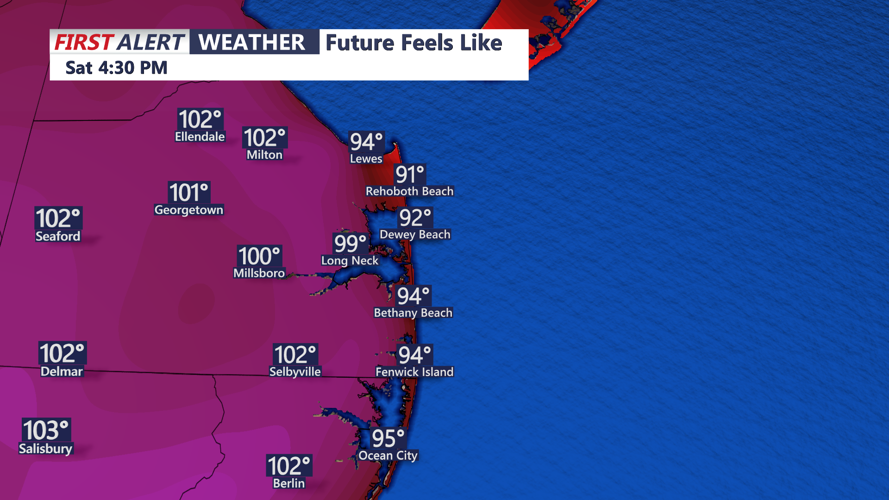
This combination will create steamy conditions, with heat indices likely surpassing 100 degrees in spots. While metro areas farther north will be under a heat advisory, no advisories have been issued for Delmarva because thresholds here are set higher at 105 degrees.

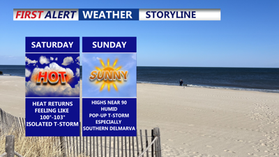
Saturday afternoon will feature the return of triple-digit heat indices.
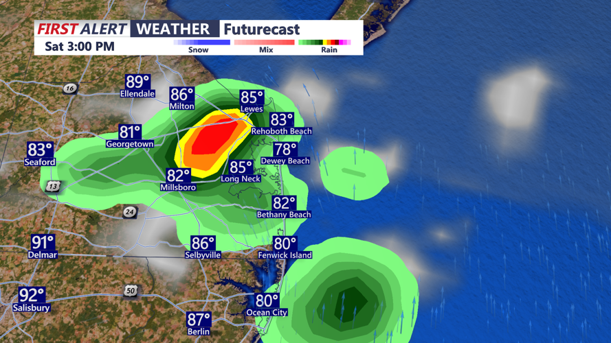
The warm and unstable atmosphere could trigger isolated sea-breeze showers and thunderstorms during the afternoon, especially in coastal Delaware. The main focus, however, will be a cold front approaching from the northwest by evening.

Isolated t-storms possible Saturday afternoon, brief downpours.
Severe threat has shifted further to the north and west, thunderstorm could still produce torrential downpours and some gusty winds.
Behind the front, some drier air will attempt to filter in, though much of the region will remain muggy overnight, with lows in the 70s.
The cold front is expected to stall near or just south of Delmarva on Sunday. While dew points may fall into the 60s for parts of the region, humidity is forecast to linger in southern areas. Temperatures will be somewhat cooler than Saturday, with highs in the 80s and heat indices lower. A few stray showers or thunderstorms remain possible where deeper moisture hangs on, but no strong focus for organized storms is expected.
As the workweek begins, a warm front is projected to lift north again on Monday, bringing another wave of warm, humid air. Highs will climb back toward 90 degrees, and heat indices will increase once more. Scattered showers or thunderstorms are possible, mainly across southwestern portions of Delmarva, with rain chances around 40 to 50 percent.
An upper-level trough will deepen over the Mid-Atlantic by Tuesday, helping drive a stronger cold front into the region. This setup could produce another round of showers and thunderstorms Tuesday afternoon or evening. Some storms may be severe, depending on the timing of the front and the level of instability that develops. High temperatures are forecast to top out in the upper 80s.
Once Tuesday’s cold front moves through, high pressure will gradually build across the region Wednesday and Thursday. While temperatures will remain seasonably warm in the 80s, dew points are expected to drop into the 60s, providing more comfortable conditions.
By 4th of July, a warm front will approach from the west, but any associated moisture and rain chances should stay well to the west of Delmarva.
