


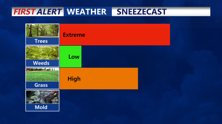


DELMARVA - High pressure will remain centered to our south and east through Wednesday. A cold front will cross our area Thursday afternoon, stall to our south on Friday, and then lift back northward Friday night into Saturday. Another cold front will move through Saturday night into Sunday, followed by a couple of systems on Monday and Tuesday.
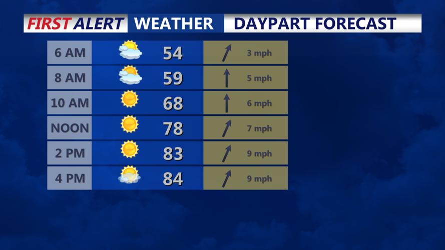
High pressure located offshore the Delmarva Peninsula will remain in place through tonight, allowing for a quiet, dry, and warm day across the area. Skies are mostly clear, with some fair weather cumulus clouds visible on satellite imagery. Temperatures are mostly in the low to mid-80s, cooler near the coast due to a sea breeze boundary slowly moving inland.
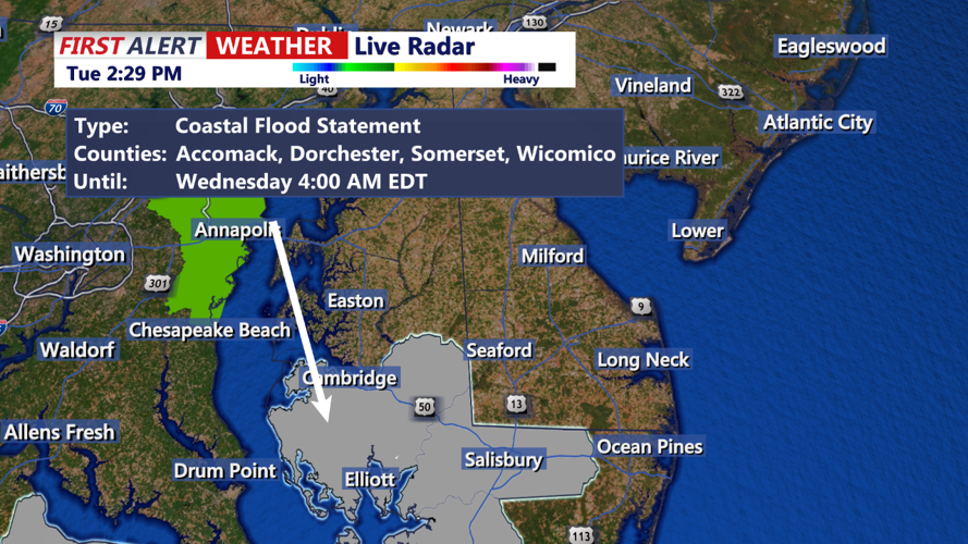
Another tranquil night is expected tonight with clear skies and light winds. Light south-southwest winds around 5 mph tonight should limit widespread fog formation compared to this morning. Hi-res guidance suggests some marine fog may push inland early Wednesday morning, but it will likely be patchy and confined to the immediate Delaware coasts. Lows tonight will range from the mid-50s to low-60s.