


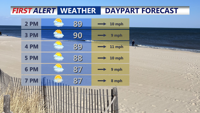


DELMARVA -- Varying weather across Delmarva, starting with sweltering temperatures and the chance for isolated strong to severe thunderstorms. Temperatures are expected to climb into the upper 80s and low 90s, with dewpoints in the low to mid 70s creating heat index values that could reach as high as 104 degrees.

Few isolated t-storms are possible late Sunday afternoon-evening, some storms could bring damaging winds and hail.
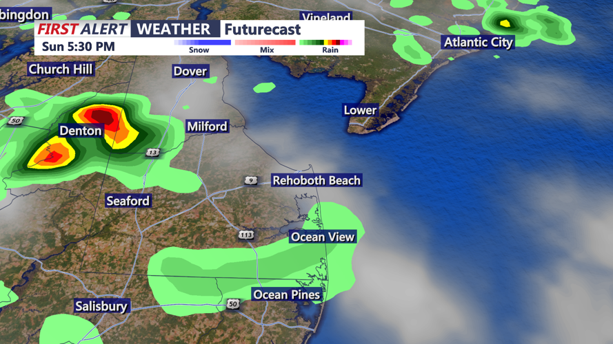
A cold front will approach from the northwest. While much of the day will remain dry due to subsidence behind a shortwave disturbance that moves through early Sunday morning, strong afternoon heating may allow isolated storms to develop ahead of the front. The Storm Prediction Center has issued a Marginal Risk (Level 1 of 5) for Delmarva, indicating the possibility of damaging wind gusts, hail, and localized flash flooding.
Filtered sunshine is expected through much of the day as low clouds begin to scatter out. Although storm coverage is expected to be limited, the environment remains supportive of severe weather. Localized flash flooding may occur with any slow-moving or stronger storms, but widespread flooding is not anticipated.

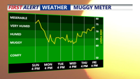
Will see a brief reprieve from high humidity Monday-Wednesday.
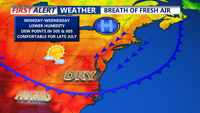
By Sunday evening, any lingering showers or storms should taper off, and the threat for gusty winds will diminish after sunset. In the wake of the front, a stretch of more pleasant weather will settle in. Dewpoints will drop into the 50s and 60s and highs will remain in the 80s through at least Tuesday. A large area of high pressure and a supporting upper-level ridge will help keep conditions dry and comfortable.

High pressure move in early to mid week bringing sunshine and lower humidity levels.