


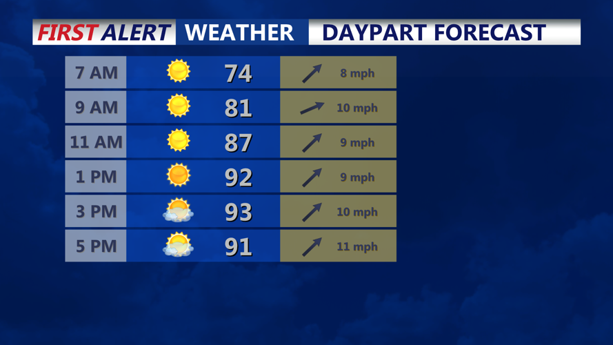

DELMARVA - Early Wednesday morning will begin mild and muggy across Sussex County, with temperatures already starting from a warm base before another round of early-season heat builds through the day.
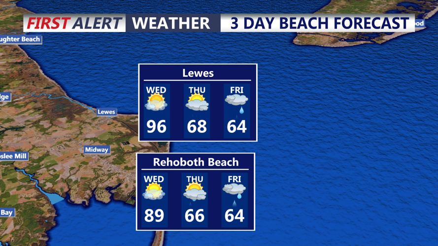
Afternoon temperatures are expected to rise into the 90s for many inland areas, though beaches and immediate coastal communities should be cooler as winds turn more southerly or southeasterly off the ocean. Heat index values near 100 degrees will be possible away from the coast.
A strong cold front will move toward the region Wednesday afternoon and Wednesday night, bringing showers and thunderstorms. Some storms could become strong to severe, with the main threat being locally damaging wind gusts from stronger storm cores or small clusters.
Rainfall amounts are generally expected to range from one-tenth to one-half inch, but locally heavier totals are possible in stronger downpours. Thunderstorms should end late Wednesday evening, though showers may linger into early Thursday morning as the front stalls near Delmarva.
Cooler and unsettled weather is expected to follow Thursday and into the holiday weekend.
