



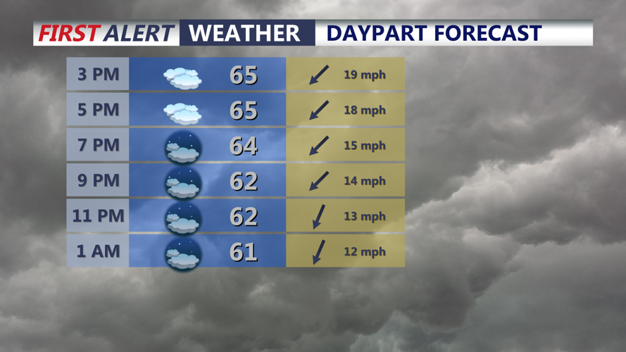
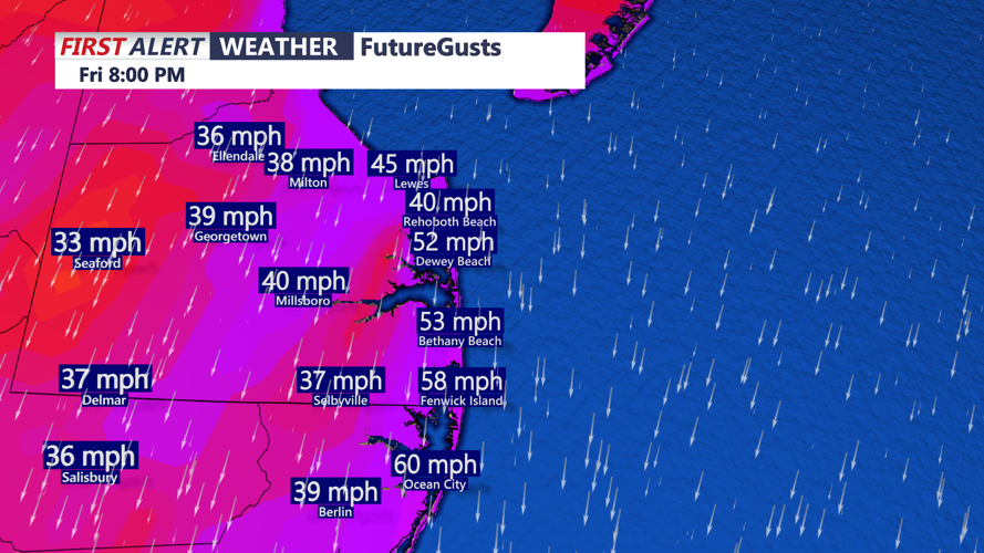

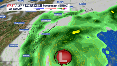
DELMARVA -- Gloomy windy conditions continue as temperatures rise into the mid to upper 60s. The wind continues to be the story with gusts 45 mph+ at the beaches, further inland gusts to 35-40 mph.

Mostly cloudy skies on Delmarva, highs in the mid to upper 80s, wind out of the northeast 20-35mph, Gusts 45+ at the coast.
Coastal Flood Warnings continue through Saturday, expecting MODERATE tidal flooding through high tide cycles. Up to one to two feet of inundation is possible. Beach and dune erosion is possible with continue wave heights of 6 to 12 feet crashing onshore.
Tonight expect cloudy skies with windy conditions, lows in the mid to upper 50s. Some drizzle at the coast is possible into Friday morning.
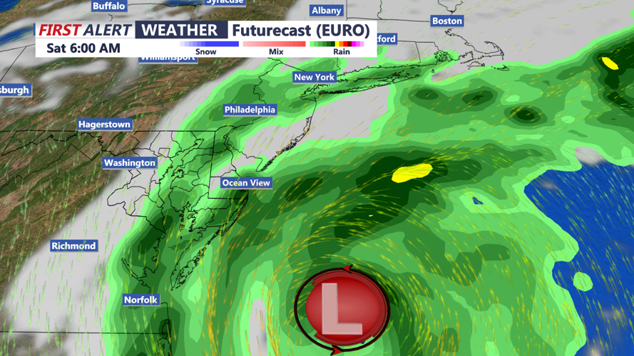
Low pressure developing well off the East Coast will strengthen and move north towards the Mid-Atlantic coast and southern New England through the weekend. Models have trended further west. This will bring the potential for rain and strong winds at the coast.
Friday will feature cloudy windy conditions. High Wind Watch is in effect for the Delaware coast for Friday evening -Saturday evening. Winds could gust as high as 60 mph.

Winds will gust to near 60 mph at the coast late Friday into Saturday. High Wind Watch in effect late Friday -Saturday for the Delaware coast.
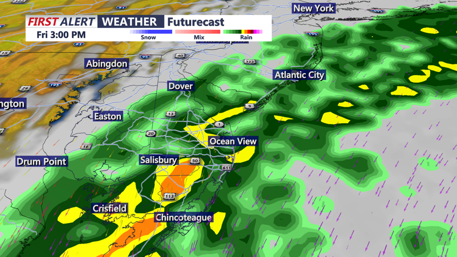
Temperatures will be in the upper 60s to low 70s. Rain will develop late in the day and persist through Saturday, rain will be heavy at times. Depending on the exact track of the nor'easter we could see up to an inch of rain along the coast through Saturday.

Increasing chance for rain, could be heavy at times late Friday afternoon -Friday night.
Saturday will be a windy dreary day, with showers likely early in the day, winds still gusting to near 60 mph+, temperatures in the upper 60s. The shower threat could persist into Sunday depending on the exact track of the nor'easter. Overall a gloomy soggy weekend. Highs in the upper 60s to 70 into Sunday.
The pattern will break into next week as high pressure builds into the region, sunny skies return and a warm up as temperatures surge back into the 80s middle part of next week.
