


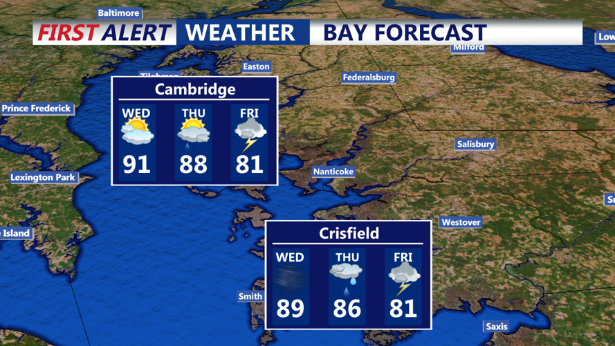


DELMARVA - Residents of the Delmarva Peninsula can expect limited thunderstorm coverage this evening due to the absence of large-scale atmospheric forcing. However, any thunderstorms that do develop are likely to produce heavy rainfall due to elevated precipitable water values.
Tonight, the region will remain under a very humid air mass, resulting in overnight low temperatures in the 70s. Coastal areas may experience marine layer fog, though it remains uncertain how far inland this fog will reach. Therefore, no dense fog advisory has been issued for inland areas at this time.
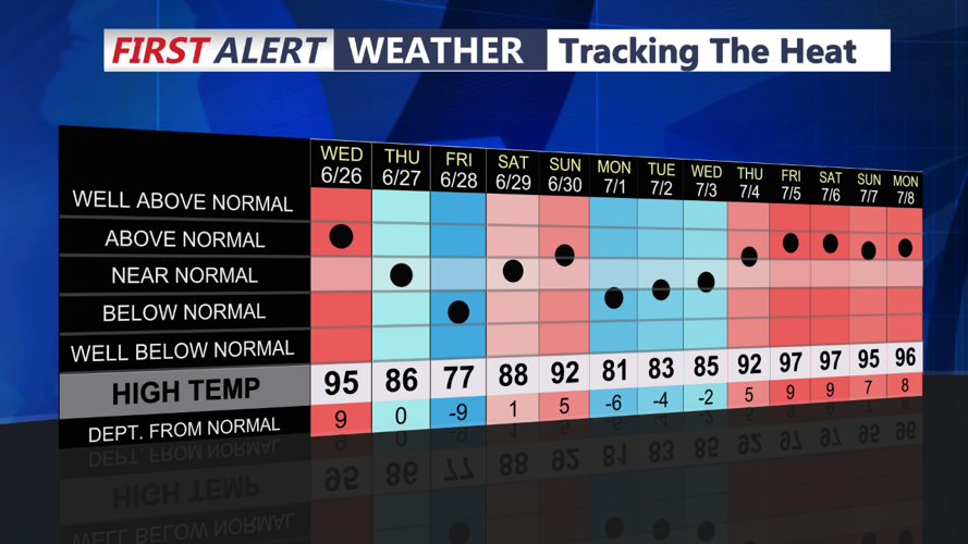
The heat remains a significant concern, with higher-than-expected dew points leading to increased heat index values. With no dry air anticipated before tomorrow, similar conditions are expected to persist. Consequently, a heat advisory has been issued for the area, indicating that residents should take precautions to stay cool and hydrated.
Looking ahead to tomorrow, meteorologists will be monitoring the remnant low of Beryl, which is forecast to stay well west of the region. While most guidance suggests the development of a dry slot on the east side of the low, there remains some uncertainty. Any storms that do develop will likely be north and west of the fall line, with heavy rain being the primary concern. Fortunately, fast storm movements should help limit the flash flood threat.
Residents are advised to stay informed of the latest weather updates and take necessary precautions during this period of high heat and humidity.