


DELMARVA - We've seen a round of showers and storms to start our Friday, with more on the way this afternoon and possibly this evening. Highs in the 60s, and possibly 70s where the sun is out a bit longer.
The rain will taper off Friday night as the low exits to the northeast. Low temperatures by Saturday morning will be chilly, with temperatures dipping into the 40s, with some 50s at the coast.
The departing low will weaken on Saturday, allowing some sunshine to return, though lingering troughing aloft may keep clouds around. Highs will begin to moderate. High temperatures will be in the low 70s, with 60s at the coast. It will feel cooler with a breeze.
Looking dry Saturday night and temperatures on the chilly side, with lows in the 50s.
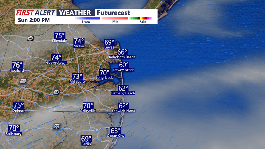
Another cold front arrives Sunday, Mother's Day with limited moisture, so going with mainly dry conditions as of now, but more in the way of cloud cover. Highs in the mid to upper 70s, cooler at the beaches.
By Monday, high pressure is forecast to build in from the west, delivering drier and warmer weather. Temperatures will rise, though light winds could allow for a sea breeze during the afternoon. Highs will be into the 70s, with cooler readings at the beaches.
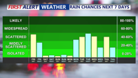
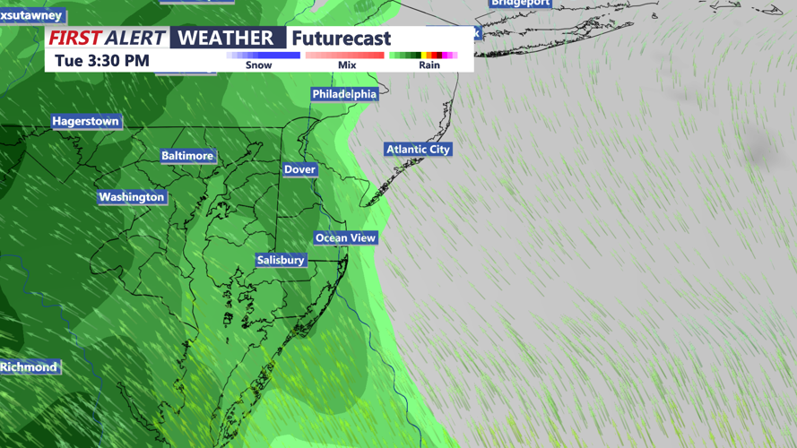
Rain chances return on Tuesday, and continue through Thursday. Highs in the 70s and 80s during the period. Some thunderstorms are possible, especially on Thursday.
